Okay, I admit it, I have a pun problem. I’m sorry you had to see that.
Once again it was time for a Peninsula ramble and another poke at old farmsteads – this time along the Nyhon track, which once upon a time was a bridle track for the early settlers running between Sandymount and Hoopers Inlet.
We headed out along Highcliff Rd, passing Two Cars Slip which is currently being repaired, a process scheduled to complete later in March. We followed a Monarch tour van down Sandymount Rd and past the lime kilns before pulling over to park opposite the steep wooden steps which would take us up on to the track.
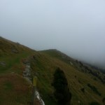
Although the day was sunny, an icy wind was blustering, foreshadowing the rapidly approaching Dunedin winter – despite the fact that we don’t seem to have had a summer yet!
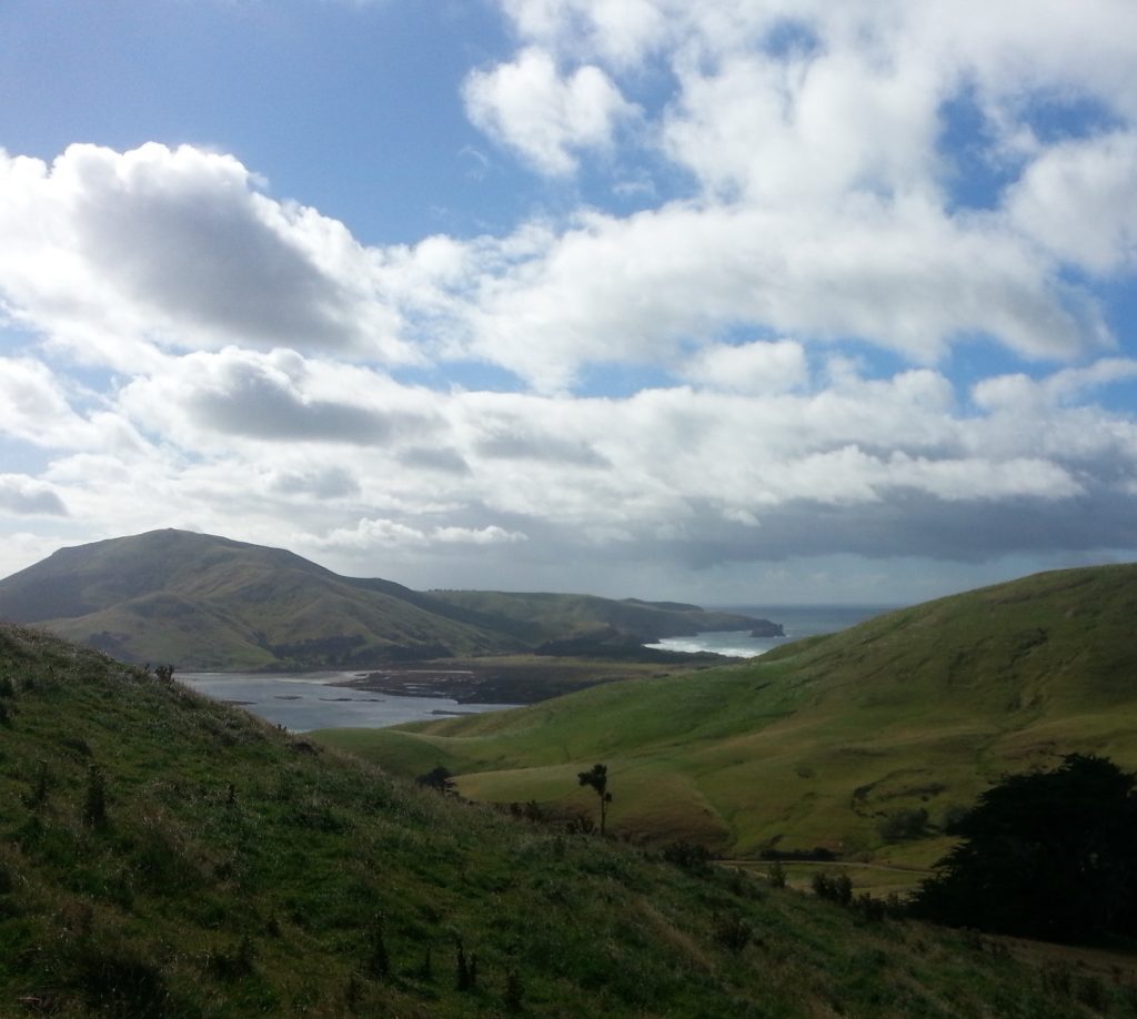
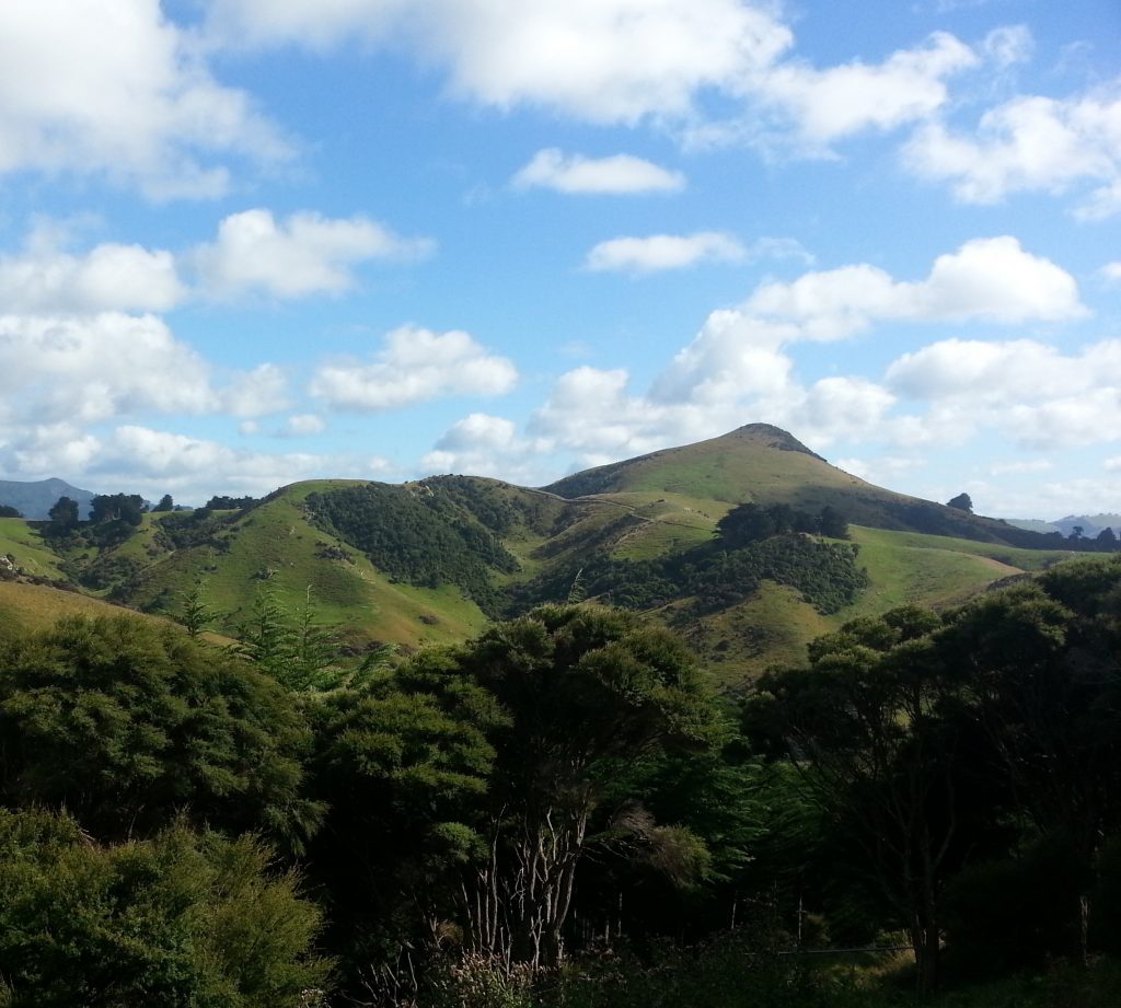
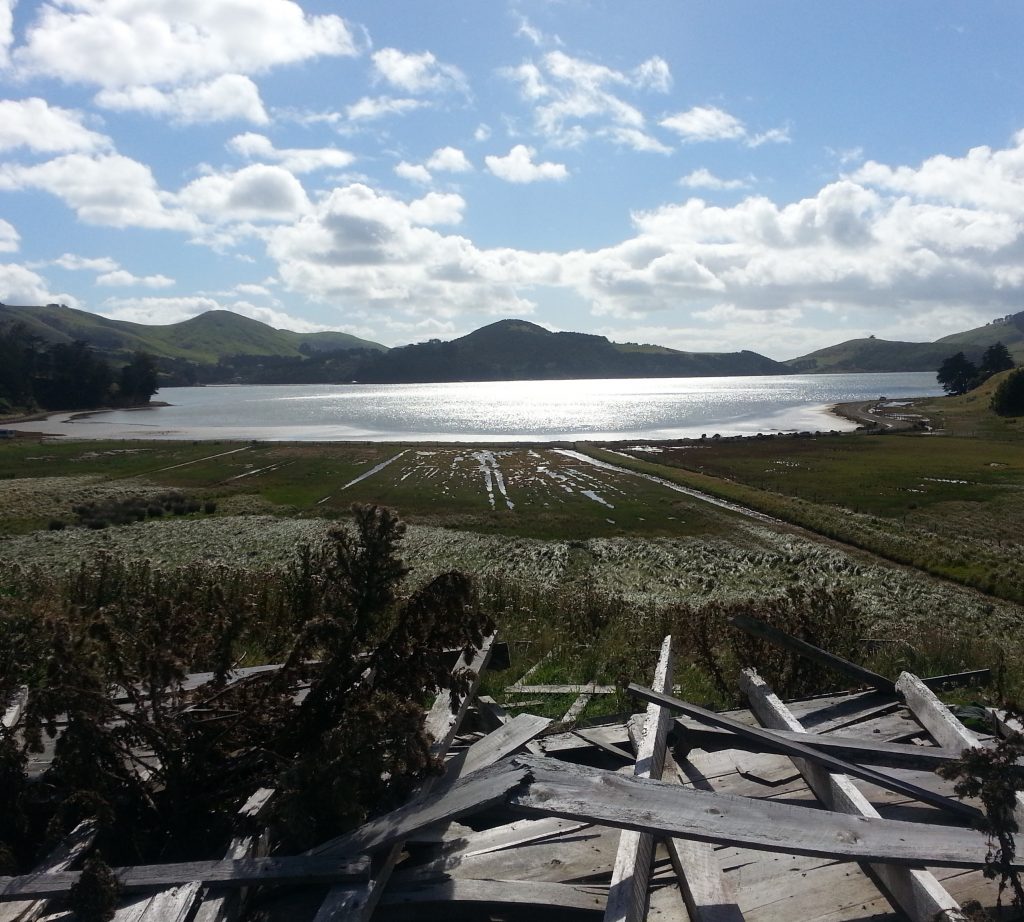
The steps took us up onto the shoulder of Dicks Hill, where a gravel drive curved up towards the peak of the hill and the site of Dick’s farm, also known as Lascar House. Seems this place is still occupied today, and we had no chance to see it as our path took us over a stile into a paddock from which we could look back toward Sandfly Bay. Craning our necks forward, we could catch a glimpse of Mt Charles and the swamp behind the Allans Beach sandbar.
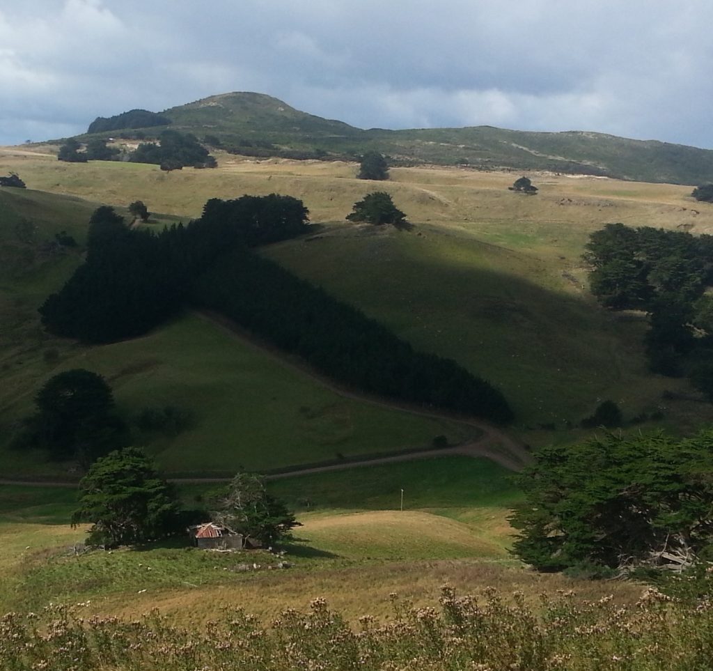
Down the gully on the right toward Hoopers Inlet Rd we noticed a very intriguing wooden ruin tucked away in a grove of macrocarpas, such that it is barely noticeable from any angle but this. The mystery is that while a building is marked on the extremely handy 1901 and 1922 maps, it is not labelled, leaving us to wonder at the provenance and purpose of the place. My natural inclination to investigate was tempered by the posted warning to stick to the track – as it crosses private land.
Almost immediately we were flummoxed, as there were no track markers, and my understanding that “it just goes straight down the hill along the fenceline” was challenged by a wall of gorse ahead of us. I lead an unconvinced Dad around the gorse and down a narrow gap which lead through a patch of regenerating scrub.
The trail lead us down a semi-disused vehicle track to a gate leading into a small conifer plantation. Since the Nyhon Track was once “Nyhon’s Road”, we figured that must be the way and headed through.
By why does this old track from Sandymount to Hoopers Inlet bear the name of this early settler family? According to the aforementioned map, there was a Nyhon’s farm by Harbour Cone and another at the farthest end of Sandymount near where the track to the Chasm passes by. Both were located about equally distant from this track.
Determined to find the answer to this puzzling question, I trawled through old newspaper records for mentions of this road, and found a reference to “Mr J.T. Nyhon’s road to Mount Charles”, involving “a…track across the lagoon”. Pursuing this thread, I discovered a John Thomas Nyhon mentioned in the context of the neighbourhood on the other side of the lagoon between 1880 and 1905. Furthermore, a John Nyhon had purchased some land at Mount Charles in 1892, and John Thomas Nyhon was mentioned as having an interest in a road on block VI of Otago Peninsula (the Mount Charles area) which was shared by the Dicksons who occupied sections 10 and 11 of that block.
So my current theory is that the “Nyhon” of “Nyhon’s Road” is John Thomas Nyhon, and that the road once used to extend across Hoopers Inlet to somewhere in the area of Mt Charles.
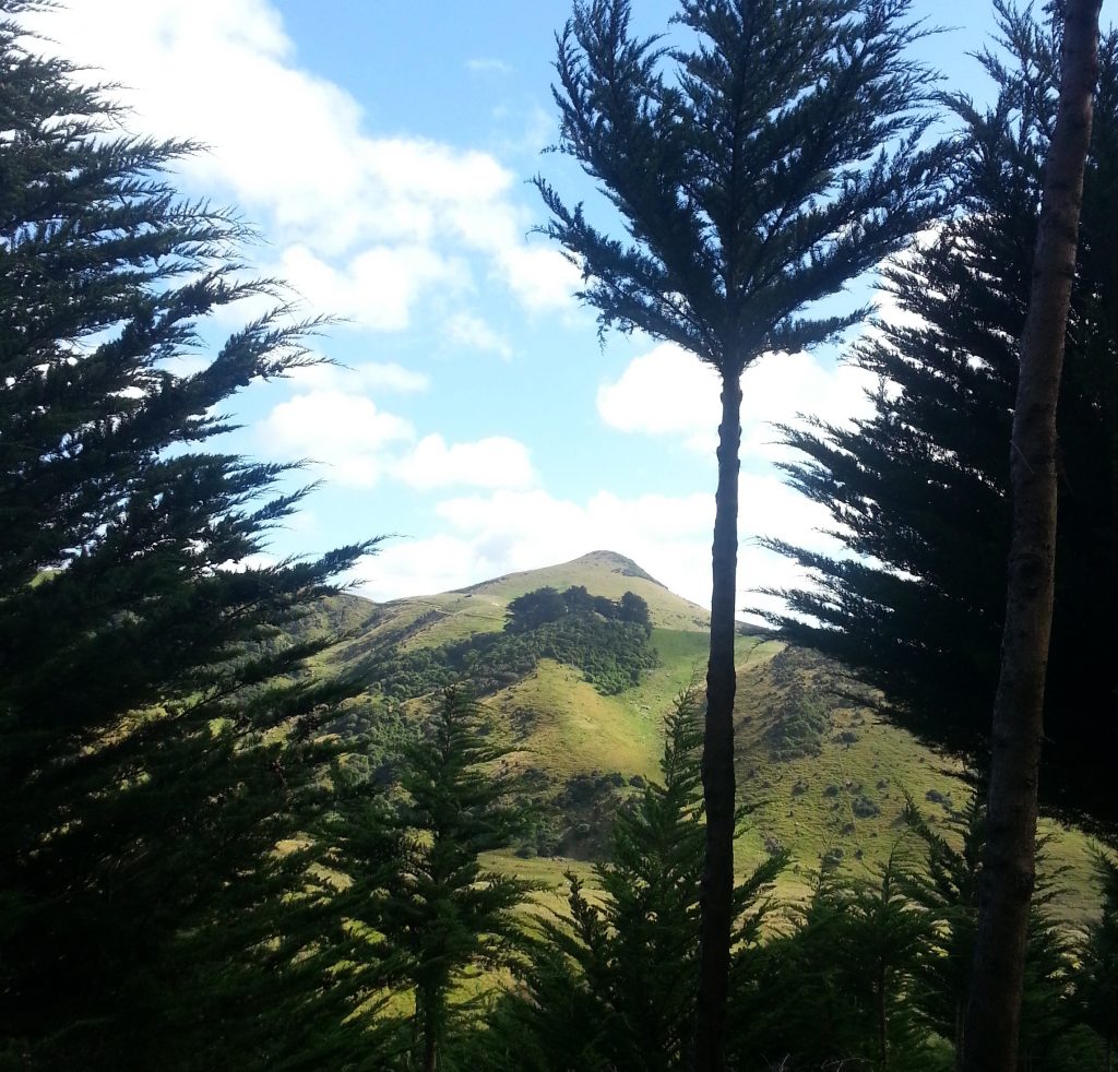
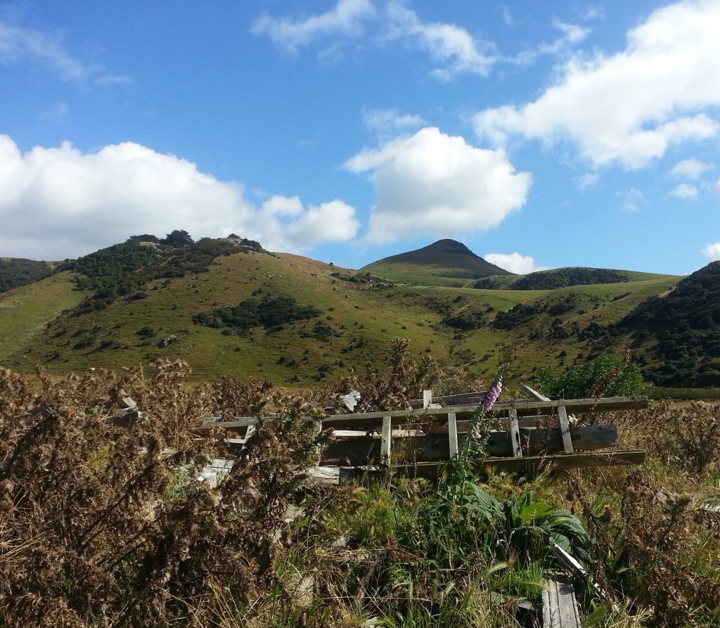
Through the trees we could make out the site of Rutherford’s Farm with the distinctive peak of Harbour Cone beyond. As I slowly learn the origin of each little clump of macrocarpas on the peninsula I am starting to build up a picture of what these little early settler communities looked like.
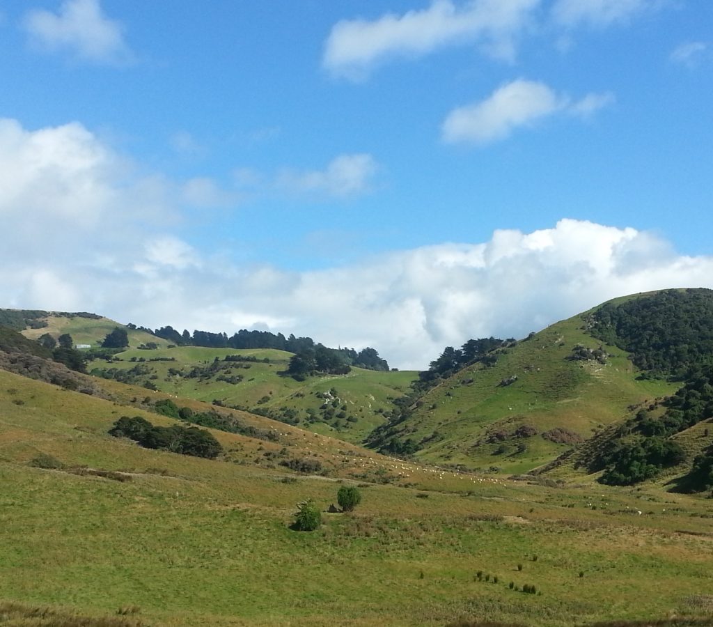
At this point we emerged from the trees into the valley of Stewarts Creek, from which we could look up to yet another old farmstead site, Stewart’s Farm, or “Down Home” as the family used to call it.
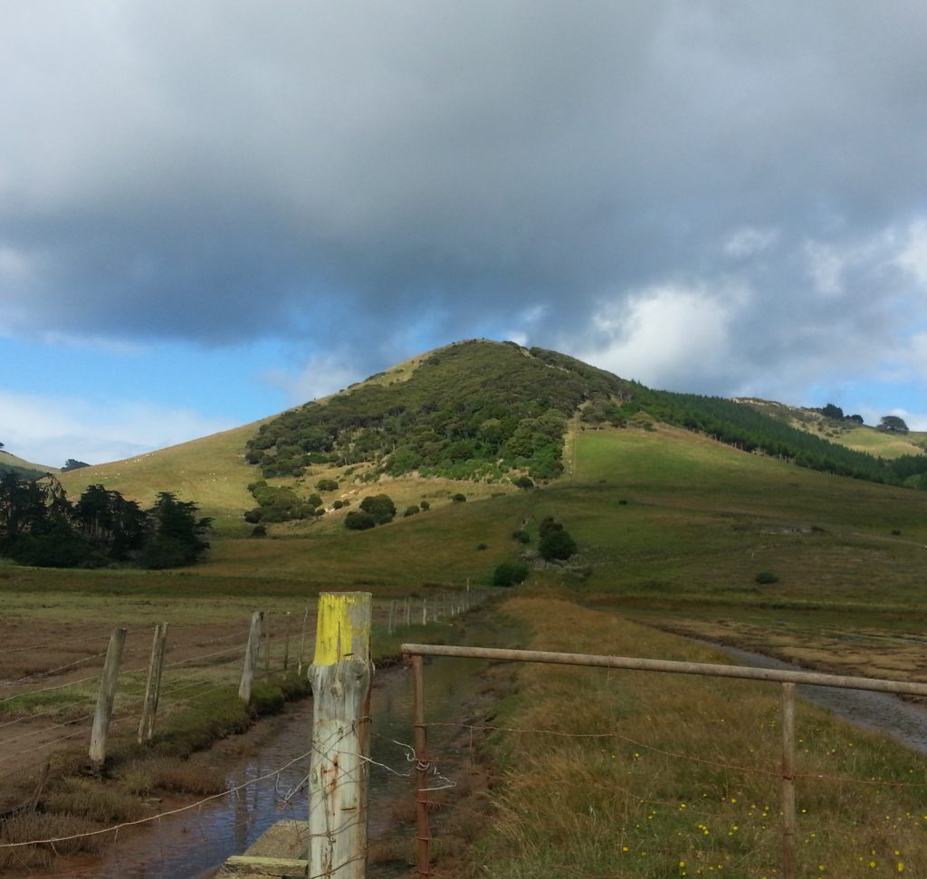
Only issue was, we weren’t sure where the track was. We wandered out into the thick grass, unable to locate any markers or even a likely looking trail. Dad was sure we should be heading towards the bottom of the valley, whereas I thought we should be over on the ridge.
As we scratched our heads, I couldn’t help but think that if we were going to get lost anyway we might as well have “got lost” in the direction of that interesting ruin that we saw earlier.
Eventually we did find a marked track, but it only served to exacerbate our argument, as it lead in one direction toward Stewarts Valley and in the other toward the ridge. Then the entire thing became moot, because I saw another ruin in the direction of the ridge and was determined to head that way whether it was the official path or not.
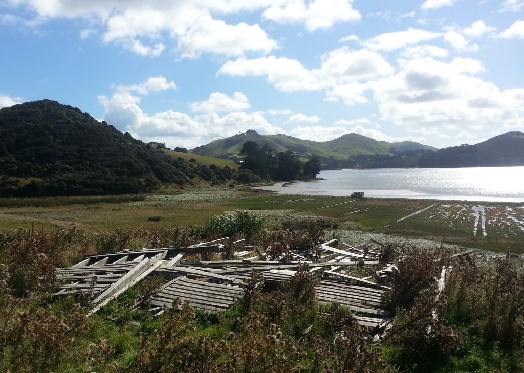
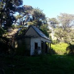
The “ruin” actually turned out to be a completely collapsed house overlooking Hoopers Inlet, bleached wooden bones at the mercy of the weather. This proved to be on the site of what was called “Kerr’s Farm” according to the maps, and proved that I was right about where we were supposed to be, because Nyhon’s Road once ran directly past it.
Tracing the history of this place was more difficult than my previous homesteads, despite the fact I’ve picked up a few good tricks along the way. I was stoked to find a famous John Kerr, who settled the peninsula after arriving on the Jura, but then was disappointed to note on further inspection that the location did not add up. Back to the drawing board.
Then I discovered Euphemia Kerr, “late of Sandymount”, wife of a different John Kerr, but that too failed to add up. By this point I was in deep, having moved beyond my usual staple of paperspast and on to the Dunedin branch of New Zealand Archives, poring over original survey plans and purchase books.
But these only informed me that part of the section had been purchased by William Larnach and part by “James Collier” who was practically non-existent as far as my sources were concerned. On the other hand, I discovered via paperspast a Richard Kerr who had held an auction at his Hoopers Inlet farm in 1899 due to an expiring lease.
My next question was, is Richard Kerr one and the same with Richard Cave Kerr, older son of John Kerr of the Jura? I managed to place Richard Cave Kerr at Hoopers Inlet in 1894, due to the sad loss of his 15-week-old daughter Georgina Helen. According to Ian J. Smith’s history of Hooper’s Inlet the same Richard Cave Kerr leased land and lived in the area until about 1900 before moving to the Catlins area. He and his wife Annie had six of their seven children here.
So before I go mad chasing this mystery I’m going to pin this place as Richard Cave Kerr’s. Should I discover otherwise in future I’ll be happy to revisit this story!
Not far from the site we found the track, littered with wood pieces and corrugated iron sheets that had been torn from the old homestead by some storm or another.
We followed this down to Hoopers Inlet Rd, where we decided to take the proper route back up, which from here clearly ran up the hill along the fence line and through the bush.
We waded through a forest of blooming thistle, while opposite Kerr’s Farm we noted the mysterious McCarthy’s Farm, cloaked by macrocarpa. Could we vaguely make out some structures? We weren’t sure, but we were intrigued.
We slogged up the hill along the fence line (as I had previously assumed), doing our best to avoid the pernicious prickles. To our left, we noticed some native trees had been recently replanted, possibly due to the efforts of landowners Sharon and Bob Morris, who have taken advantage of council grants to replant some of the forest native to the peninsula.
We emerged over the grown of the hill and back into the paddock from which we had begun our journey. A few sheep looked on as we braved the cold wind across the field, over the stile, and down the rickety staircase.
The Nyhon track had left us with considerably more questions than answers, and what answers I did have were mostly guesses. Still, I’d explored another little corner of the Peninsula and added a few new pieces to the puzzle that is its early settler history.
References:
ROAD BOARD MEETINGS. Otago Daily Times, Issue 13590, 11 May 1906
PORTOBELLO ROAD BOARD. Otago Daily Times, Issue 12628, 3 April 1903
COMMERCIAL. Evening Star, Issue 8879, 16 July 1892
OBITUARY Otago Daily Times, Issue 21165, 24 October 1930
DEATHS. Otago Daily Times, Issue 12334, 23 April 1902
CLEARING SALE AT HOOPER’S INLET. Otago Daily Times, Issue 11761, 16 June 1900
THIRD EDITION. Death. Evening Star, Issue 9521, 19 October 1894
Hoopers Inlet by Ian J. Smith
Farmers giving back to the land by Kim Dungey
I’m loving having you tell us the history of these places Amanda. As for getting lost, have you discovered the Walking Access WAMS map? https://www.wams.org.nz/wams_desktop/index.html On the Layer List Widget icon in the left-hand bar, you can toggle coloured overlays which show public access land – public roads are shown in purple. The Basemap Gallery icon at the top right lets you see the topo map or aerial photos. The More/Sketch to GPS icon on the left-hand bar lets you draw a series of waypoints and download those to your GPS. Now you can see exactly where Nyhon Road runs and (gorse allowing) follow its legal alignment.
Thanks Jane, it would have been a good idea to have looked at that before we went!
My great great grandfather John Kerr settled this area and I have in our records a photo of his house and other details. He built the first house in this location.My mother who is 97 can fill in the gaps of the family names you mention. John Kerrs daughter Mary Jane married a David Young of Sandymount. Other daughter married 2Dicksons brothers.
Hi Pauline, that is wonderful that you know a bit more about this mystery. If you or your mother would like to send in some information so I can fill in the gaps, could you email me at amanda@nunn.nz?
Hello Rob Roy MCINTOSH here I’m 65 and the youngest son of Olive Margaret KERR Owaka . Olive grew up in Owaka and rode to school on a Clydesdale 3 up with sister Madeline and brother …
Olive married Roy MCINTOSH from Dunedin Kaikorai.
Anyway any interest wld be appreciated
Rob
Have just found this site as my uncle, Richard Cave (Dick) Kerr, Grandson of your Richard Cave Kerr died this week. Dick was the son of Richard James Kerr, third child of Richard Cave and Annie Kerr, farmers of Otekura, my great grandparents. Family knowledge places my grandfather as being born in Portobello. He married Marion Cunningham Kirby in Owaka and my mother Marion Helen was born in Owaka.
Re the Kerr House.
I am writing to you from TARANAKI. I am the great great grandchild of John Kerr who arrived on the Jura in Otago. I am a genealogist in my spare time and have been gathering up family history of my parents. John Kerr was my mother, Joyce Youngs great grandfather. I have in my possession a photo of the original John Kerr house and some associated newspaper references to his background which may be of interest to you. I am retired now and have on my bucket list a walking tour of this area. My maternal grandfather and great grandad both David Youngs farmed in this area and lastly Sandymount. The Morris family were cousins and neighbours and I understand still have farms in this location. Looking forward to hearing from you.
Hi Pauline! Wonderful to hear from a descendant of the Kerrs. I have sent you an email
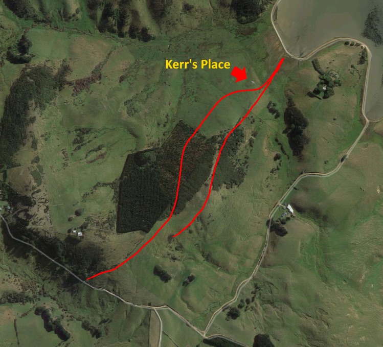
Brilliant blog, Amanda. I had my own adventure on the Nyhon track last weekend. I was doing a training run on the Peninsula (and have been exploring some of the tracks and trails as part of my training in recent weeks). I found my way to the stile from the Lascar driveway where the signs indicated the Nyhon track went and crossed over, passing downhill through the paddock where I assumed the track went (sans markers) along the fence line beside the plantation. I hadn’t gone more than 20m before I heard an angry voice shouting and saw a man on the small hillock straight ahead (the highpoint on the ridgeline). “Get back on the track!” He was too far away to have a conversation and hand signals didn’t seem to be getting me anywhere so I backed up to the driveway to make sure I wasn’t mistaken. Sure enough, I was clearly on “the track” and a couple of steps further along the drive revealed a “private property” sign. I returned to the paddock and attempted some hand signals with the ?farmer who seemed to be indicating to me to head off into the forestry block to the left through a gate. This took me well off to the left and down the next ridge along down what was, for the most part, a well formed farm track (apart from some thistle filled fields midway down). I got to the bottom and it was only when I got home and looked at my GPS tracing that I could see how far off the track I went (though admittedly there were some variations between the various maps I found, they all approximated the ridgeline straight down the hill).
All of this is to day that the either track has significantly moved (and remained unmarked), the ?farmer was unaware of where the track actually went or else he was trying to divert me from something else that he was up to.
I think I will try again another time but next time from the bottom and hopefully no more run ins with irate farmers!