That’s right – another foray into Palmerston’s hinterland! While I have my hands on George Griffiths’ excellent book detailing interesting localities in the district surrounding this little town north of Dunedin, I figure I might as well make the most of it. Shag Point, or Matakaea as it is known in Maori, is an old coal mining area situated just north of the Shag River mouth.
We loaded up the Canyonero in the persistent drizzle that has been plaguing Dunedin for the past week, and headed north once again, hoping our journey would lead us to kinder weather. Our cruise up the highway was interrupted only once as a dog wandered out onto the road, and vehicles backed up behind me as I waited for it to cross. I hope its people found it before it came to any harm.
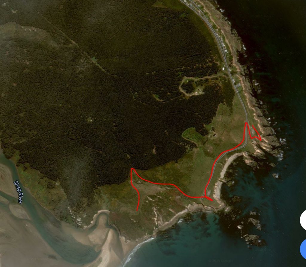
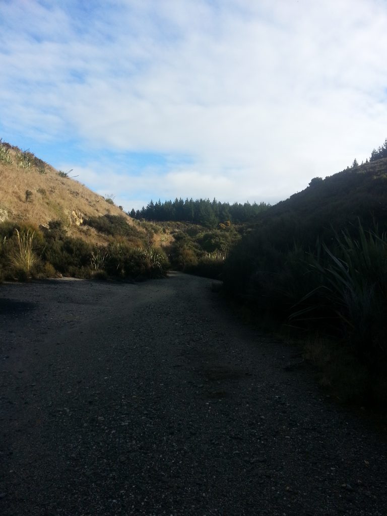
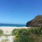
Then we passed through Palmerston, crossed the Shag River and climbed over a low saddle before finding the road to Shag Point on our right. We followed the narrow road past a long row of coastal baches before reaching the rocky and windswept DOC reserve.
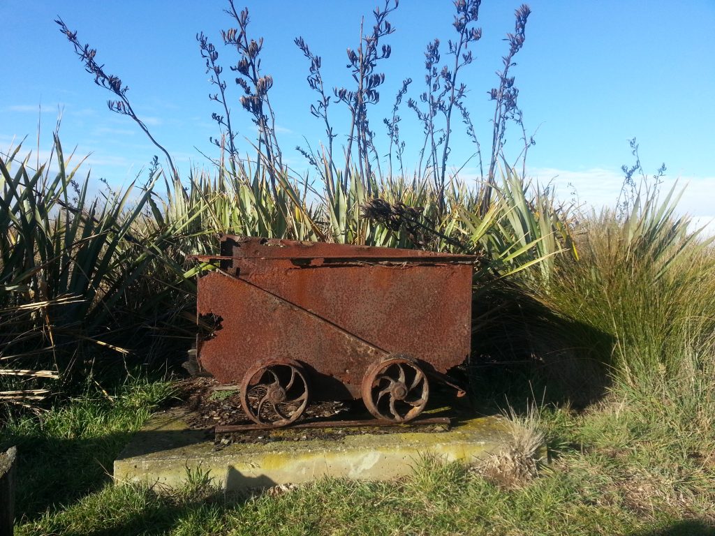
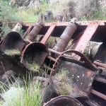
Pleased to note that the sun was shining, we disembarked from our vehicle only to be blasted by icy wind, the kind that sets your ears aching. Hats and hoods were quickly applied before we proceeded to explore. Nearby was a reminder of the locality’s mining history.
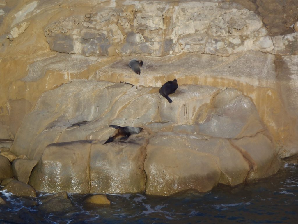
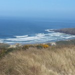
The first thing to do was walk out to the rocky point to have a gander at the local seal colony. There were six visible, a mere shadow of the thousands that would have lived on this coast before the arrival of humans. The early Maori who settled to the south on the sand spit at Shag River Mouth, having come across the ocean from an island environment lacking large game, must have thought they were in paradise when they arrived here to find easy access to both moa and seals. They consumed this bounty with wild abandon – although the site was occupied for perhaps only 50 years it was estimated that it might contain the remains of between 3300 and 9240 moa. Mother and baby seals were taken just as often as adult males.
Of course, this couldn’t last forever and when moa and seal populations crashed new strategies of subsistence had to be found. By the time Europeans arrived the Maori had a complex system of resource collection, trading and management.
What a shame that the Europeans did not learn from the lessons of the Maori, as they set about plundering the resources of this new land in much the same manner. Seal populations took yet another hit, and the result is this sadly depleted (and highly protected) little colony.
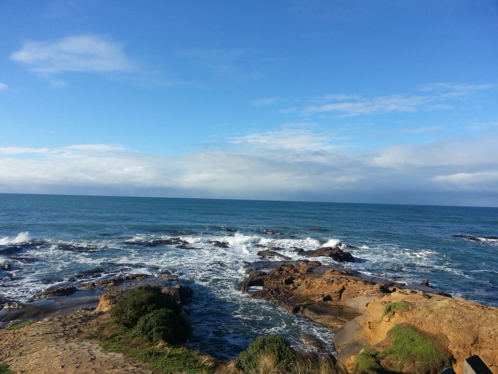
Beyond the tiny sheltered natural harbour that provided a convenient sunning spot for the seals, the wild ocean surged against the rocks, thick beds of kelp swirling in the wash.
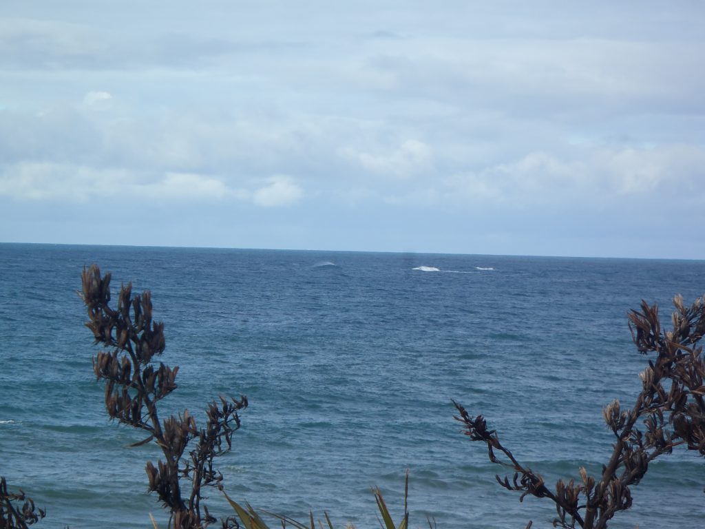
Somewhere out here is the treacherous Danger Reef, which has claimed several ships, including the Banshee in 1871 and the County of Ayr in 1905. This is another case in which listening to the local Maori might have saved a lot of grief, as in Otago tradition the reef is itself a wreck. The legendary Arai Te Uru which brought kumara to New Zealad from Hawaiki was wrecked here and thus unable to bring its cargo further south, a neat allegory which explains the fact that kumara cannot be grown in the cold southern climate. We’ve already met one of the stranded crew members in the form of Aonui, and very soon we will meet another.
We squinted into the distance to see if we could spot any sign of the reef, but could only make out some distant breakers that might indicate an obstacle below.
Forced to retreat by the blustering wind, we passed the natural harbour and its slowly collapsing boat shed and followed the road further around the headland. By the final car park there’s a short walk out to another rocky point, beside which is an interesting concrete structure enveloped in hebe.
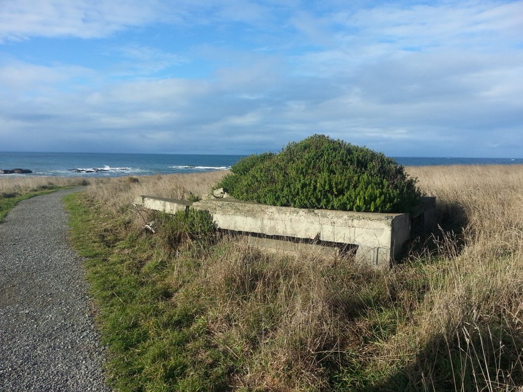
I circled the structure and peered through a large crack. As I suspected, it hid a sheer shaft partially blocked by dirt. I wouldn’t trust that dirt though, as George Griffiths reported of one of the shafts here that if only a large man were to jump on the garbage clogging it, it would all go crashing down to the sea 65 metres below.
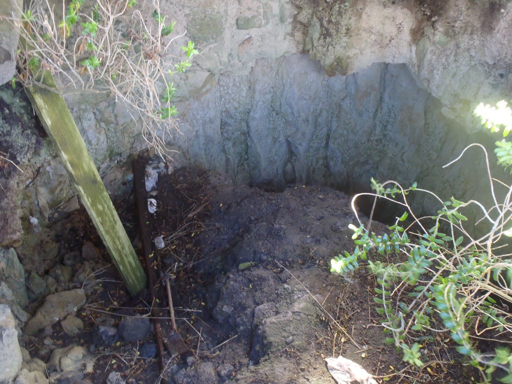
I think this is the one he identified as the return air vent of Shag Point’s last proper commercial mine, which terrifyingly extended quite some distance under the sea. The earlier workings from the late 1800s, which I didn’t manage to locate, also tunnelled under the sea, with pumps and a dam employed to keep flooding at bay. In a shocking twist, the leaky 19th century undersea coal mine was eventually closed as unsafe. Apparently the miners underground would hear the throb of boat engines as they arrived at the harbour above.
Mining continued on land until the 1970s and all in all about 100,000 tonnes of coal was taken.
Also by the car park was a depression with a set of rails only just visible amongst the overgrown grass. Perhaps the mine cart from earlier once ran along the track.
We spotted a stile that brought us over the fence where the public road ends. Since nothing was signposted, we debated a little as to whether the continuing track was still public. A later check did indicate that we were still on DOC land, although whether DOC wanted us here or not was still debatable.
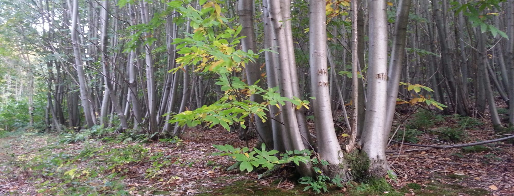
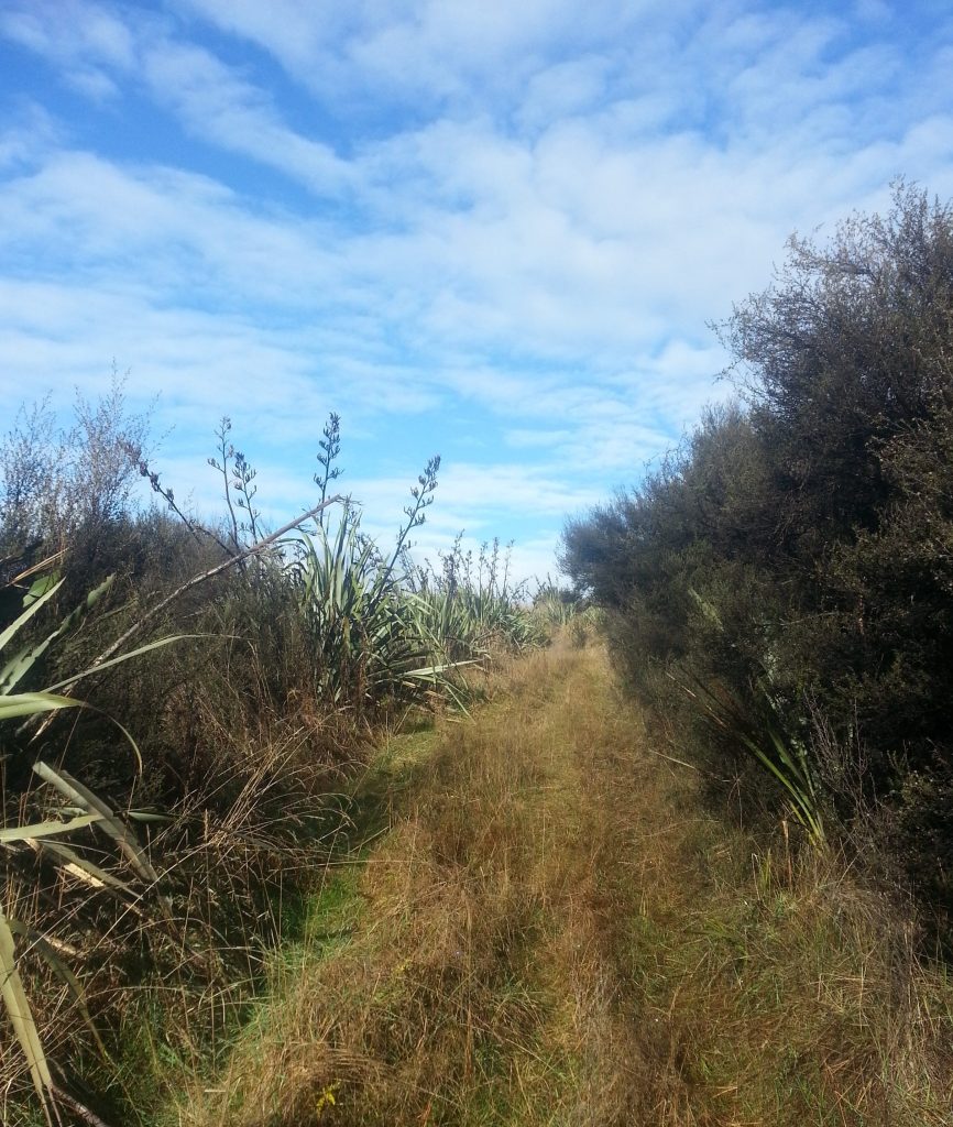
The flax-flanked path took us up a sheltered valley towards the forestry plantation on the hill. We soon encountered great heaping drifts of gravel and what appeared to be flakes of coal. We poked around a little, wondering if the entry to the mine was about somewhere, but gave up pretty quickly since we didn’t want to find it suddenly by falling into it.
We followed the track up a hill and through what might possibly have been a deliberately-planted forest of flax. While I didn’t manage to get a good view back over shag point I did eventually realise that I was a lot closer to the cliff than I’d thought. Good thing I was keeping to the path.
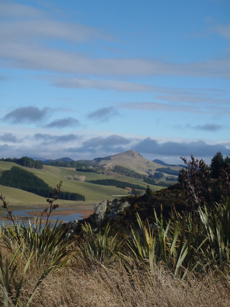
Finally we ran up against a fence, and although the track continued on the other side, we felt we’d be pushing our luck to assume it was still public. On the plus side, we sere able to look out over the Shag River estuary and up the valley all the way to Puketapu.
So we returned the way we came, back to our vehicle and back to Dunedin’s drizzle. Unfazed by our visit, the seals of Shag Point yawned and went back to sleep, waiting for a time when they would once more populate this coast in their thousands.
References:
In the Land of the Dwindle River by George Griffiths
The Penguin History of New Zealand by Michael King
Rocks, Reefs and Sandbars: A History of Otago Shipwrecks by Bruce E. Collins
The Welcome of Strangers An ethnohistory of southern Maori A.D. 1650-1850 by Atholl Anderson
The Archaeology of Otago by Jill Hamel
Another wonderfully told adventure.
Fascinating! My Great Grandfather, Seth Lloyd, was a miner from Wales and lived for a time at Shag Point. I presume he was employed in the mines there. Another question to find the answer to in my family story.
My parents and my four older brothers and sisters also lived at Shag Point during the depression. My father was employed ‘ on the dole’ forming the road around Katiki. My sister started school at Shag Point.
So interesting to read your blog. Thank you.
Really interesting to me too this area, and have just seen associated with your article a photo of the shaft poppet head where the coal was brought up. There appears to be a tub line at a higher level where tubs of rock and rubbish (mullock) from the mine went out seawards to dispose of mullock at a tippler. I didn’t know about the return air shaft until your post. On the other side of the hill behind the mine as you travel towards Palmerston to your left is what looks like an old railway formation winding towards the hill. I have often wondered if that was once an access railway or tubway towards a possible entrance to the mine, though I know the Shag Point railway from the Point connected across the SH1with the main NZR line up a still visible embankment on the seaward side just to the north.
George Griffiths was a family friend.
Very interesting information. I came across the webpage while researching my Father, John White Christian. He was a teacher in Dunedin from about 1924 to 1967 when he died. I have details of his teaching career from 1938 to 1967, but nothing from 1924 to 1938. I have a very faint memory that he may have taught at the Shag Point School during this time. I would be thrilled to know and have some details, if any one could help. Sincerely, David Christian.