It’s another scorcher of a Waitangi Day, and I do like to spend such days appreciating our beautiful land and its history, so I gathered a handful of like-minded and thoroughly-jabbed friends for a little road trip. North was our course, heading for the land of Duntroon and the vanished world thereabouts.
Fortified with enough snacks to feed a legion, we made our way up the highway while I did my level best to impress with stories of my previous adventures.
“See!” I cried. “That’s the site of Otago’s first farm! And over there is the hill that almost killed the last person who let me arrange an adventure for them! There’s the turn off for Shag Point, which sounds funny but actually they had a terrifying leaky undersea Victorian coal mine! And that’s Moeraki, but we all know about that…”
After learning that two of our party had in fact not previously visited our famous Moeraki boulders, I immediately took command and insisted on a detour. Only once they had adequately admired the lost food baskets of Arai te Uru would I consent to continue our journey.
We made it to Duntroon without further distraction, and disembarked at the Vanished World Centre, where we hoped to find more information regarding our intended adventure. We were not to be disappointed, as the knowledgeable lady therein furnished us with a Vanished World Self Drive trail map, and introduced us to the rattling stones – which could sometimes be found in a nearby creek bed. So fascinated was I that I briefly entertained the idea of abandoning our current adventure in order to search for rattling stones.
But no! We had a quest to fulfill!
…As soon as we checked out the town. Because down the street I spotted the one thing guaranteed to draw me in like nectar does a bee – informational signs.
The Brewery Hole was our first introduction to the pitted and perilous land we’d be exploring.
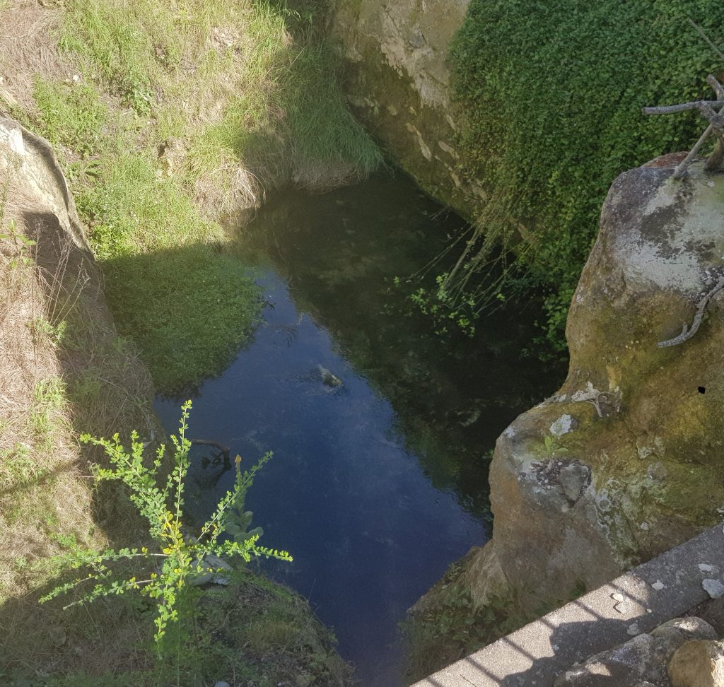
Here the confluence of two underground streams has collapsed the cave roof, offering a glimpse into the underground world beneath Duntroon. It is so called because brewer William Wishart Whitmore briefly operated a brewery here sometime around 1869-1872, during the heady Gold Rush days. By 1877 it was abandoned, and a commenter of the time describes a picturesque scene of the small building built half way over the clear pool, beside it a natural archway and a flight of steps leading down to the water. Sadly the arch was collapsed in the 1960s during work to improve the Duntroon water supply.
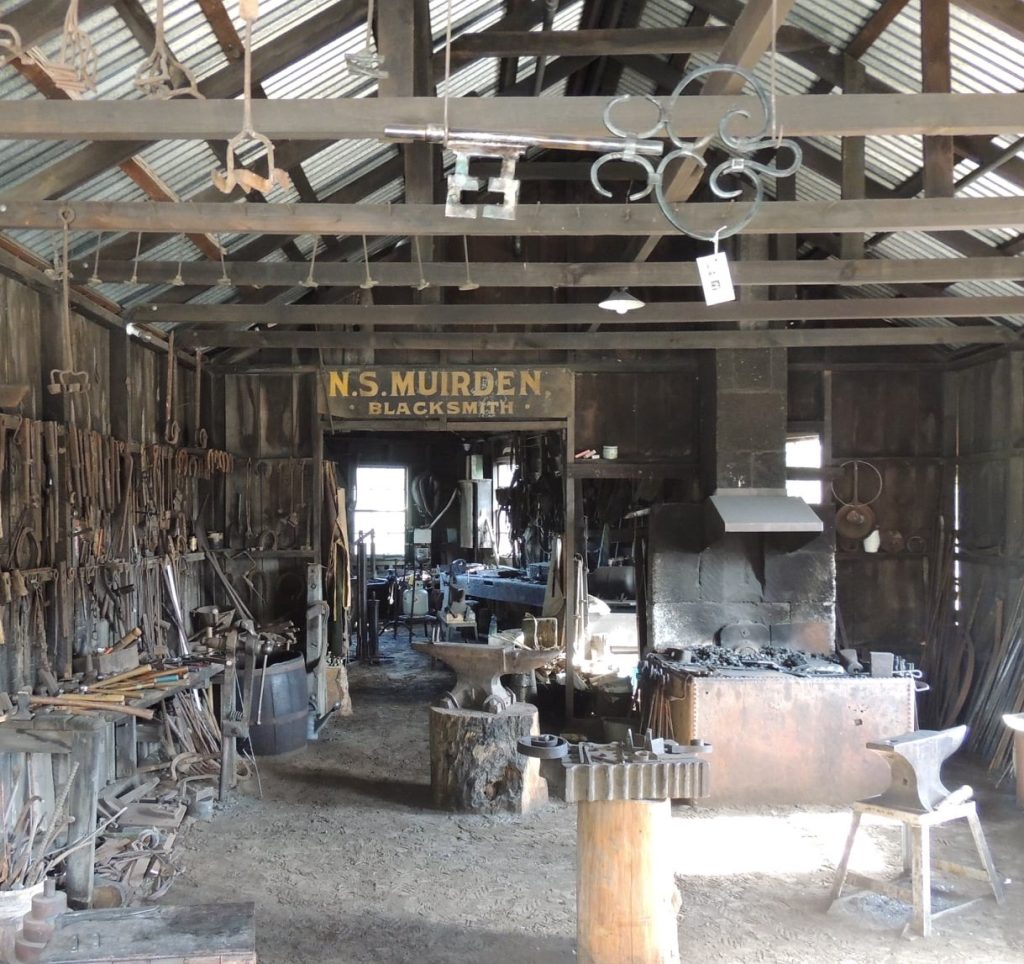
Now the brewery is gone, it’s only remnant being the name of this now-archless feature. The site is now owned by the Nicols Blacksmith Historic Trust who manage the historic blacksmith shop just next door. The Nicols Blacksmith Shop operated from the 1890s to the 1970s, and the trust has maintained it to the point where they still give demonstrations today!
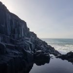
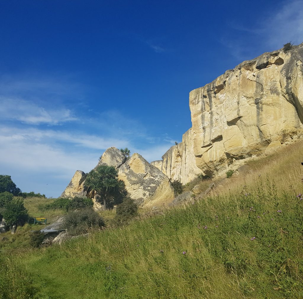
Now it was time to visit the first real stop on our trail. We decided to take it counter-clockwise, so this was the Takiroa Maori rock art site just west of Duntroon. It was the imposing limestone cliff which at first arrested our gaze, pitted and stained by long years of exposure to the elements. Echoing from the dark recesses was the sound of fluttering wings and coos from the pigeons that now made this place their home.
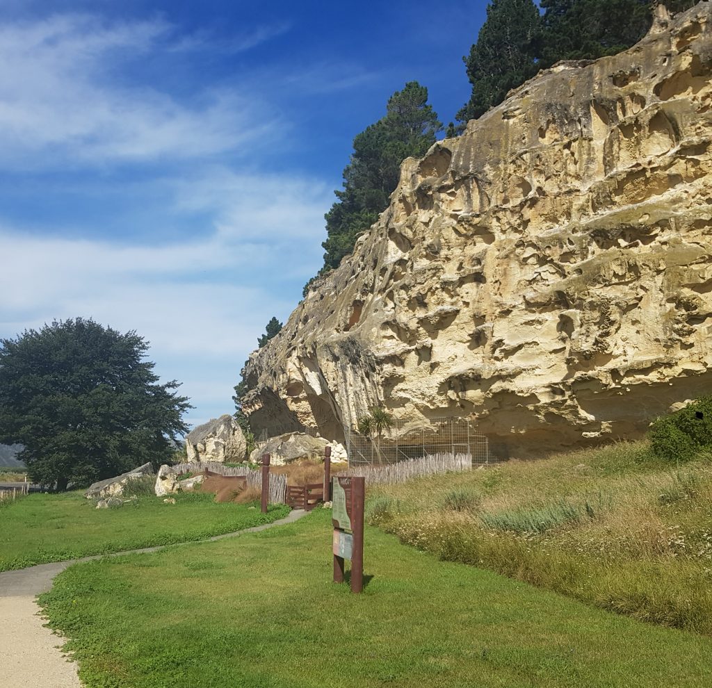
At the base of this imposing cliff is an overhanging shelter whose human history goes back to the days when moa roamed the land. We know that for certain because moa bones have been found here, meaning it could have first been used up to 1000 years ago when this valley would have served as a pathway between the mountains of the Southern Alps and the East Coast.
The art here can be grouped into three distinct classes. The first was painted in red ochre and charcoal by these ancient moa-hunters. There may then have been a break in usage of this site, as massive fires – perhaps set by humans – changed the whole ecology of this valley. The moa and other birds such as native quail that were hunted here dwindled to nothing, and I imagine this would have been a time of great change.
Then the artworks resume at some point post-1770, and this time include European-style ships and men on horseback.
The third group of “art” belongs, of course, to the vandals, and is the reason this artwork is now ensconced in a metal cage. And now, on this Waitangi Day, we are visiting this place, and can observe just a small fraction of the disrespect that has been aimed toward the native occupants of this land. The art here may well pre-date the Mona Lisa, it may be some of the first ever art created in New Zealand, yet somehow there are people who cannot resist carving or scrawling their own contribution.
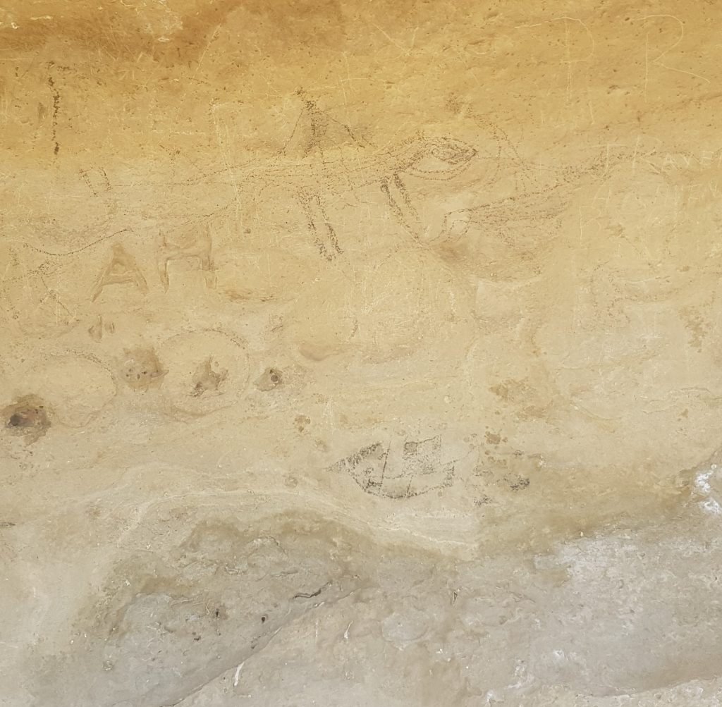
And while it cannot be considered art in any sense, there are also a number of blank depressions in the rock, where samples of the art have been scooped out and placed in museums, at the cost of the integrity of the site.
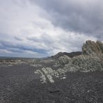
Our next stop was the locality of Earthquakes, which acquired its moniker according to the theory that this was the cause of the fractured landscape. However modern thinkers attribute it instead to an enormous landslide.
In the sultry heat of the afternoon the prospect of hiking up the steep hill was daunting, though the violet vipers bugloss flowers and attendant butterflies made the climb more palatable.
The track led out to a small plateau beneath the cliff where we were rewarded by more information and the famous whale fossil behind its protective cage. The 26ish million year old fossil seemed smaller than I expected, despite its estimated length when alive being an impressive 6-8 metres.
For some reason the next stop on our map was a golf course, and I’m still not entirely certain why, but we obediently made our way there, crossing the Maerewhenua River (home of rattling stones) as we drove.
Having duly admired the green and its contribution to the surrounding cultural landscape, we returned to the main loop route, on which the next attraction was the Tokarahi Limeworks. We had to squint from afar as it appeared to be on private property. Not much later we passed through the Tokarahi itself, not much more than a small cluster of buildings.
The trail now curved back toward Duntroon and we reached our favourite stop of the day – the Anatini Fossil Site and Narnia film location!
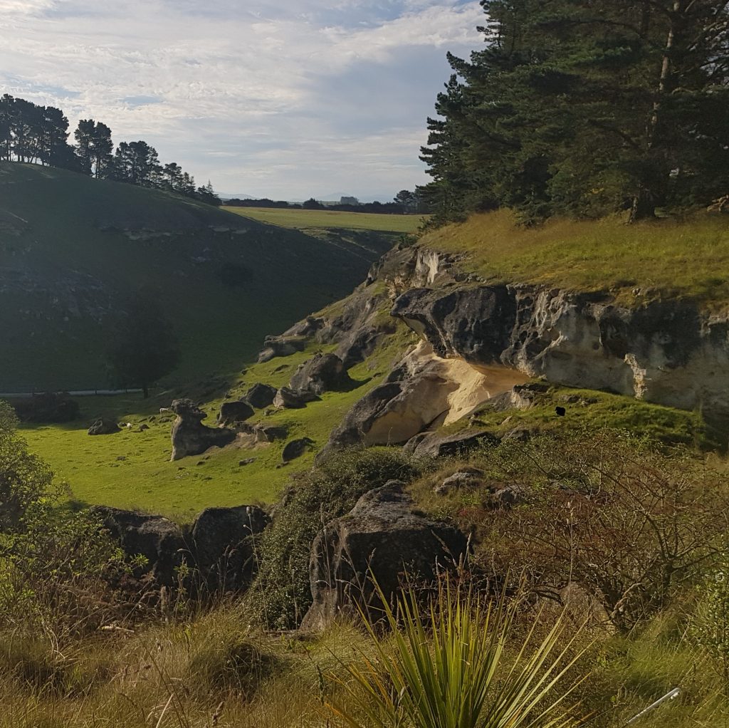
This was a hidden valley of emerald grass and swooping limestone formations that was once presented to movie-going audiences as Aslan’s camp. We frolicked a while and checked out the fossils – another baleen whale – on a ledge where they were hidden behind plexiglass.
Although this place was our favourite, the trail’s most famous attraction was just coming up! We scattered sheep as we crossed the paddock and came to a place where the land swept downward, revealing the massive rounded outcrops below, casting long shadows in the afternoon light.
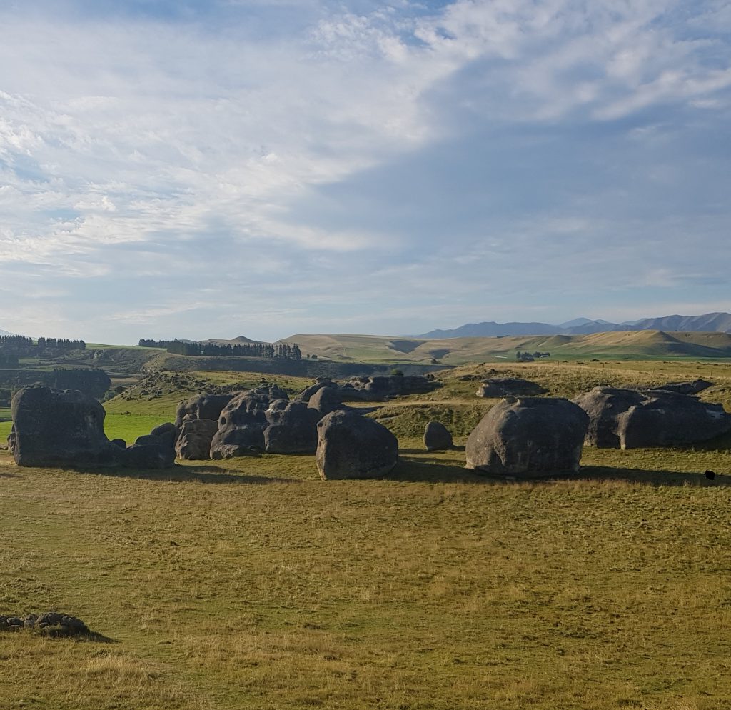
We wove our way around the stately giants, placing our hands on them and admiring their gargantuan size from our puny viewpoints.
Now the sun was getting low, but we had one more stop on our trail. Like bookends, our journey started and ended with rock art, this time the Maerewhenua rock art site. This was quite similar to Takiroa and speaks from similar tradition, offering a short climb to a metal cage through which we can catch a fleeting glimpse of a lost way of life.
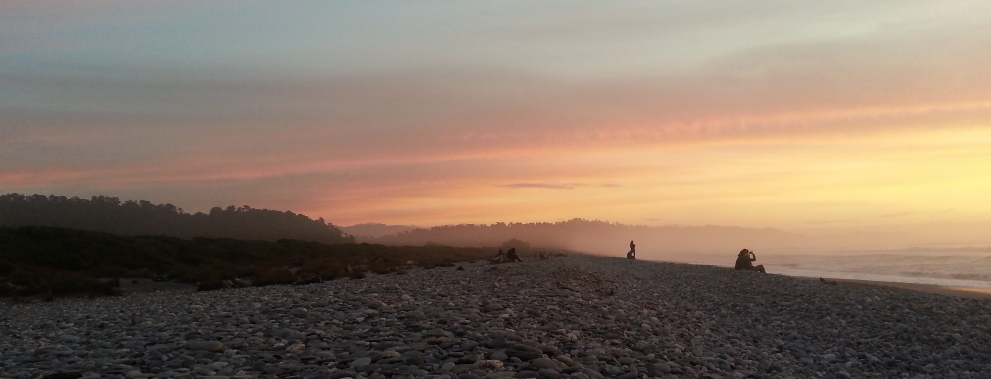
Now the shadows were getting longer, so we said farewell to the stones of the Waitaki Valley in all their strange and imposing shapes, the rattling stones and the elephant stones, and the stones that still sang with the dreams of New Zealand’s first artists.
References: