We had finally made it, Auntie and I, to the place where our forebears had first become Kiwis. Here we would combine the best of intergenerational research techniques across our 30 years of experience in order to tell the stories of our ancestors. We arrived to a week forecast for back-to-back rain, but I didn’t let that daunt my adventurous spirit. From our base camp at the Devon Hotel I was determined to walk the shore line all the way to first landing, so when Auntie opened the blind to reveal a grim grey sky I conceded only so far as to put on a jacket before informing her that I would meet her at the first landing monument.
I made my way to the Te Henui Stream, and from there down to its ocean outlet, once the northernmost extremity of the intended settlement of New Plymouth, aptly described both then and now as being bordered by beautiful shrubs.
I turned left to follow the shore, which in its current stormy state seemed far from friendly.
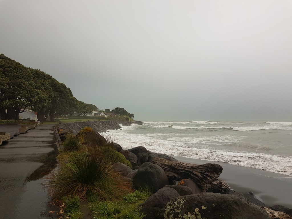
As the embankment rose above me and the rain pelted down I approached a site to which I have an ancestral connection – the first of many I would encounter in this fertile North Island province. Fort Stapp, part of an array of nine blockhouses built around the besieged settlement of New Plymouth at the time of the First Taranaki War, once perched above the sea here overlooking the city’s northern approaches.
But I am concerned with an event that occurred soon after the First Taranaki War was finished, though the settlers felt far from safe in the brittle peace that followed. Due to lingering concerns one of the British regiments that had been sent over to sort out the trouble – the 57th or “Die Hards” – stayed on to garrison the town.
In early 1861 two privates from this regiment, Frederick Nichols and John Bland, came down to the beach below Fort Stapp to bathe in the ocean. Three drummer boys joined them but one got into difficulty and called to Frederick for help. Both men rushed to assist and although the boy was saved one of them did not survive.
Like when George Nunn narrowly avoided being crushed by a cart in Suffolk, this event marks another butterfly effect moment in the chain of events that would eventually come together and produce me. For it was Frederick who survived, and Frederick is my great-great-great-grandfather.
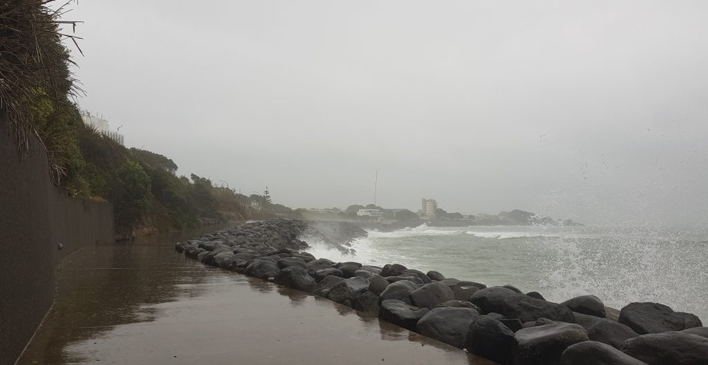
Fort Stapp was part of New Plymouth’s outer ring of defence and now as I approached the seaward end of Liardet Street I crossed its inner line, a continuous ring of trenches and palisades that encircled the town, hastily constructed during the winter of 1860 in the wake of British defeat in the field.
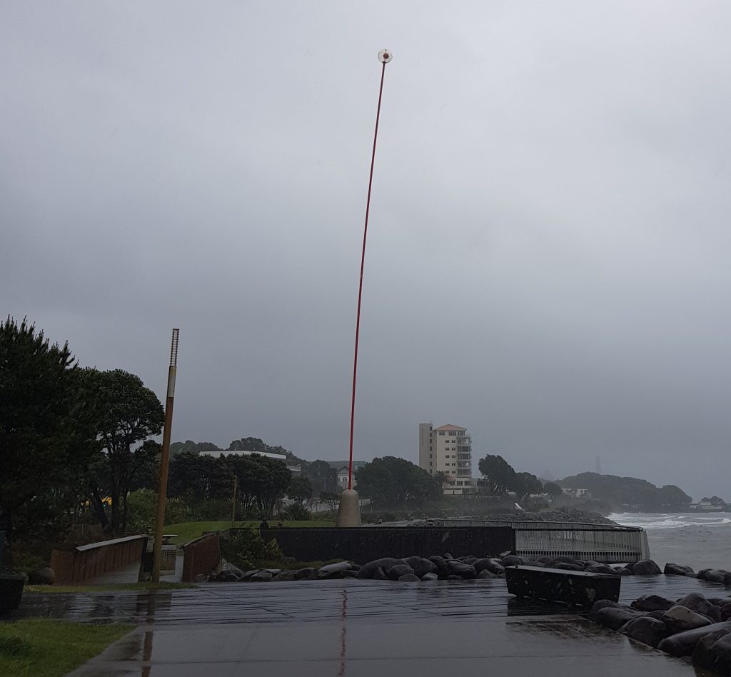
Now, of course, the city spills right over the old line and the fears of those days are forgotten. Ahead of me through the fog I could finally see one of modern New Plymouth’s most recognised icons, the 48 metre Wind Wand, a posthumous tribute to artist Len Lye.
This place at the outlet of the Huatoki Stream also has an ancestral connection for me, as it is where the settler immigrants from the ship Timandra came ashore in February 1842. Among those seeking a new life in this young colony was the Parsons family, and I am counted among their many descendants.
Onward I slogged into the driving rain, past the CBD and across the rail line once again. Drawing even with the Aquatic Centre I peeked under the water slides and noticed something more interesting, an artillery piece perched on the bank overlooking the ocean. I investigated, but there was no sort of explanation accompanying the weapon.
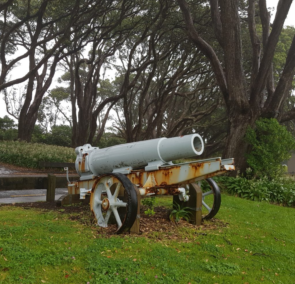
Turns out this 21cm Krupp siege howitzer is just one of a large shipment of captured German weapons distributed around the country in 1920 as trophies in the wake of the First World War – 11 siege guns in all, a large amount of smaller artillery, and over 1500 machine guns. This one is said to have been captured in Belgium by the New Zealand Rifle Brigade.
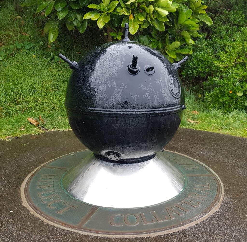
Not far beyond I found a reminder of yet another war, an article of death now become an art piece. This naval mine was one of three that washed ashore in the New Plymouth area during the Second World War, thought to have been laid by the German navy off the South Australian coast.
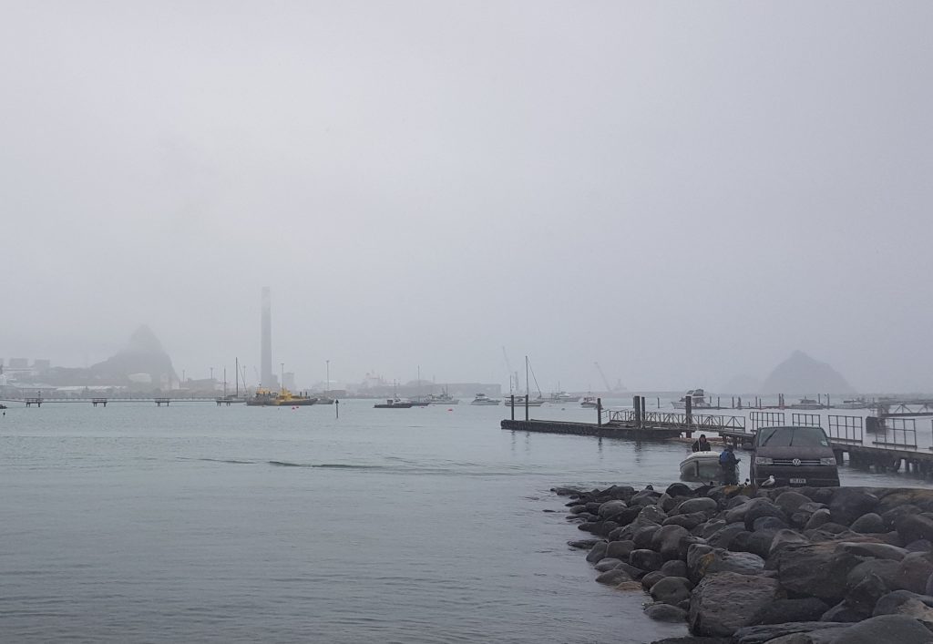
Finally I reached the asphalted car park at Port Taranaki. Looking across the enclosed man-made harbour I espied the misty forms of Paritutu, the Sugar Loafs and the 198 metre New Plymouth Power Station chimney, once the tallest structure in New Zealand and now second only to the Sky Tower. The power plant itself was decommissioned in 2007.
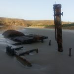
I carried on behind the dock side buildings along Ocean View Parade, admiring the occasional mounted anchor or propeller along the way. Back beside the ocean again I discovered a monument of a different kind: Oil Well Number 4, a tribute to oil exploration on the Moturoa Oilfield.
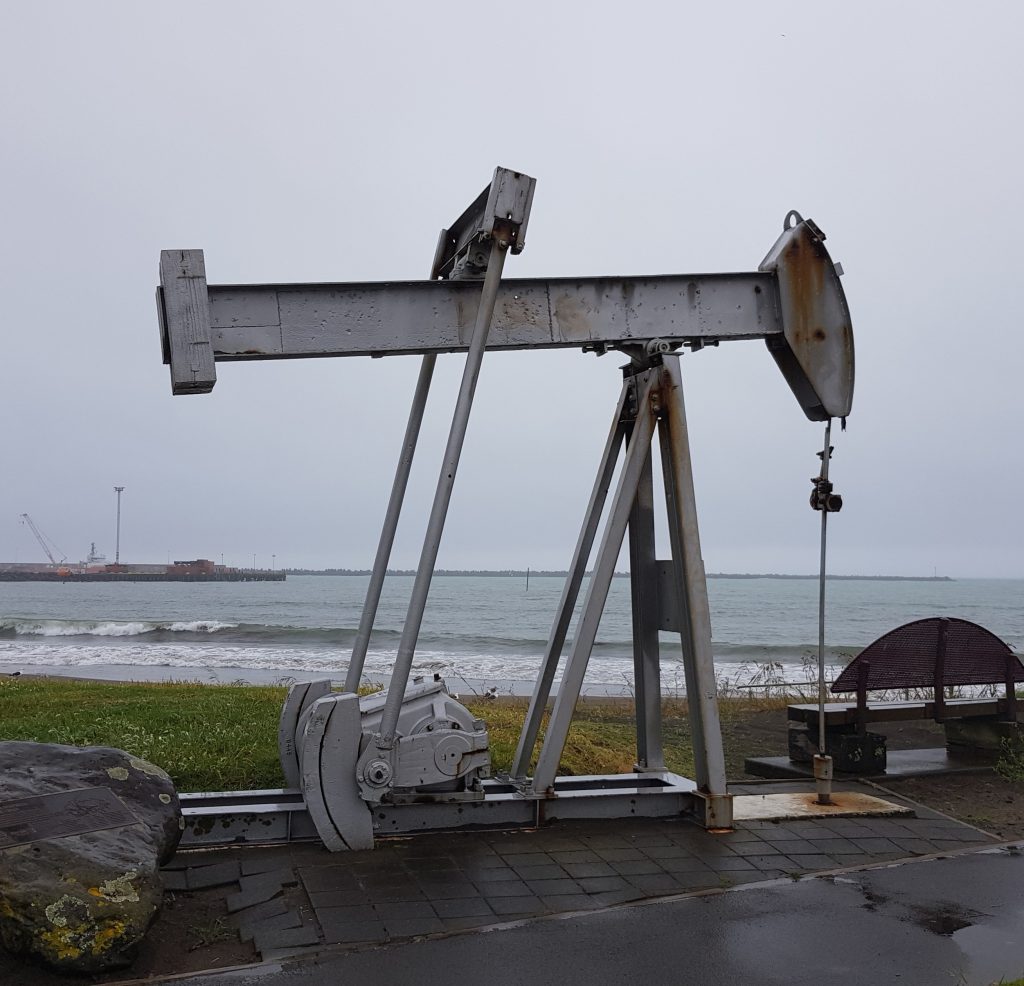
Prospecting for oil began here in 1865, making it one of the oldest oil fields in the world. The industry didn’t really take off until 1905 and continued with ups and downs over the years before closing in 1972, though a small trickle is still gleaned from the last remaining well.
Here was the end of the road for me, a locked gate firmly in my way. So I followed a narrow path up the bank behind to finally reach Pioneer Park and the end of my journey. This little park overlooks the spot where the first two settler ships landed their passengers after the long journey from England, and is close to where the first temporary raupo shelters were erected to house them.
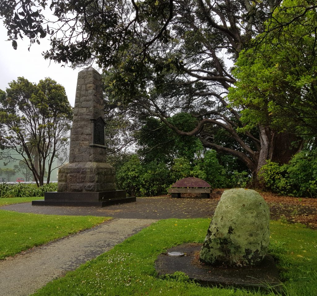
There’s a monument to the six New Plymouth Company vessels here, erected in 1911. More recently six boulders have been placed around the park, each recording some aspect of this area’s history, from the days it was occupied by the pa Otaka and fishing village of Mataipu, to the visitations of whalers, arrival of the Plymouth settlers and even the oil field days.. There is also a replica mast (the original was too decayed to re-erect) from the vessel Australind which ran ashore here in 1882.
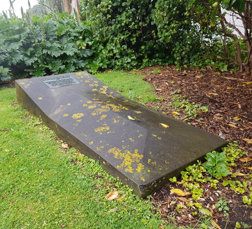
Most sacred of all, however, is a single grave tucked away in a corner, that of Poharama Te Whiti. Poharama was a resident of Otaka who defended it in the 1830s against Waikato and later became a friend to the settlers, acting as a go-between during troubled times.
Shortly before his death, he made the request to be returned to his ancestral home.
Wet weather walk over, all that remained now was to await Auntie’s arrival. My 6km journey had provided an educational peek into the past of this unfamiliar city, though my supposedly water-proof jacket had not held up as well as I might have hoped. Yet somehow Auntie had anticipated my difficulty and arrived with a full change of clothes, allowing us both to seek a warming lunch in dry comfort.
Once lunch was done, another journey was to begin, in the footsteps of our ancestors as we began to uncover their story.
References:
Fortifications of the New Zealand Wars by Nigel Prickett
LOCAL INTELLIGENCE. Taranaki Herald, Volume X, Issue 497, 8 February 1862
The Terror of Liege Now a Silent Watcher of Children at Play
New Plymouth Power Station Chimney
One of the world’s oldest oil fields continues to pump in New Plymouth by Tara Shaskey
Such a beautiful place! I love the scenery of rainy shore!
Awesome! I would love to walk around here everyday! I hope I can visit this place sooner, maybe after pandemic. That type of weather is perfect.
Jen
https://www.proplumbernorthshore.info/