Continuing a recent series of explorations around the Leith Valley area, we thought we’d visit Sullivans Dam…the long way.
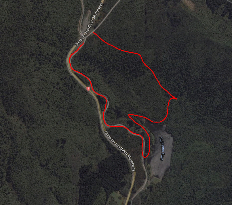 So we cruised up the northern motorway until we reached the saddle, then parked at the intersection of Pigeon Rd and Leith Valley Rd. We walked only a short distance up Pigeon Rd, before Dad directed me up a set of almost-invisible steps at the roadside.
If you’re thinking of coming the same way, look for a white signpost with nothing written on it (don’t you love a bit of mystery?).
We slipped through the tall wet grass and into a narrow path through the trees.

The manuka was flowering, leaving tiny white petals scattered on every surface. The going was somewhat tough, as we had to step over fallen logs and navigate muddy patches. But at least there was no chance of getting lost, despite the roughness of the path, as any other direction would have been impassable!
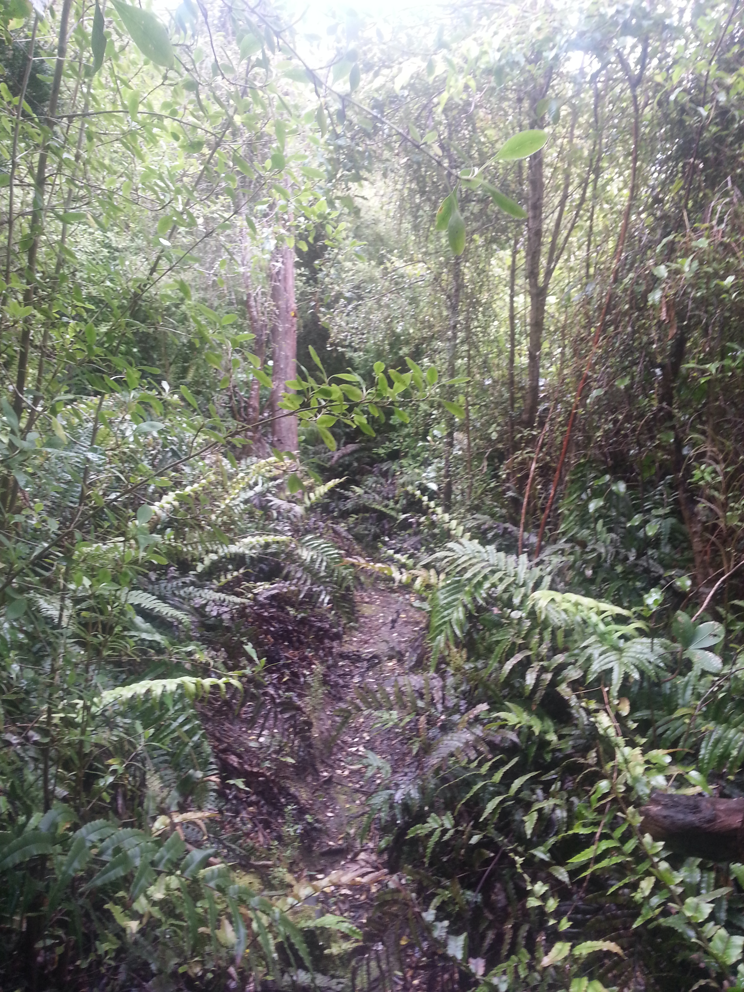
The track took us uphill, and at one point we had to scramble up a wall of slippery boulders.
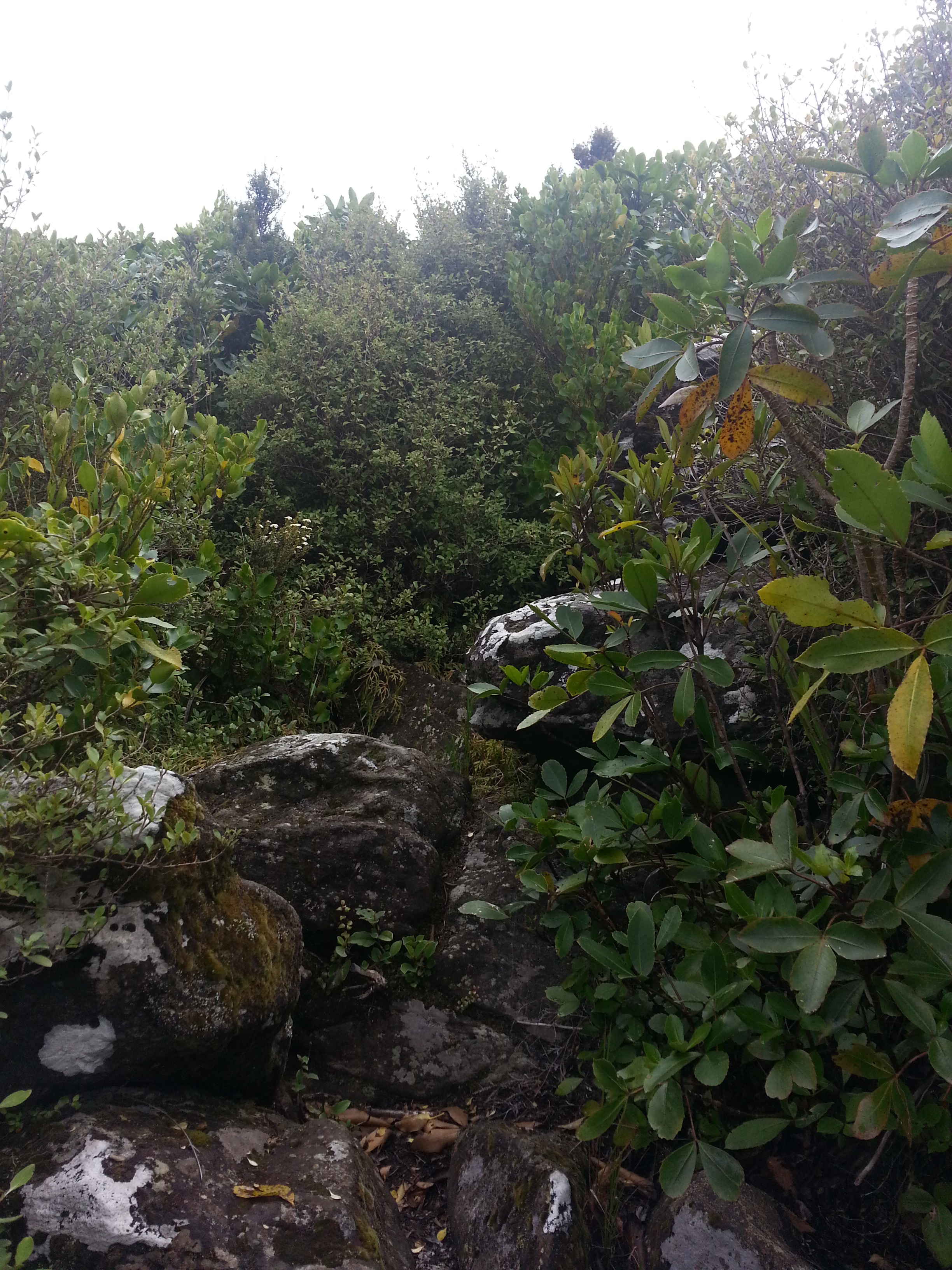
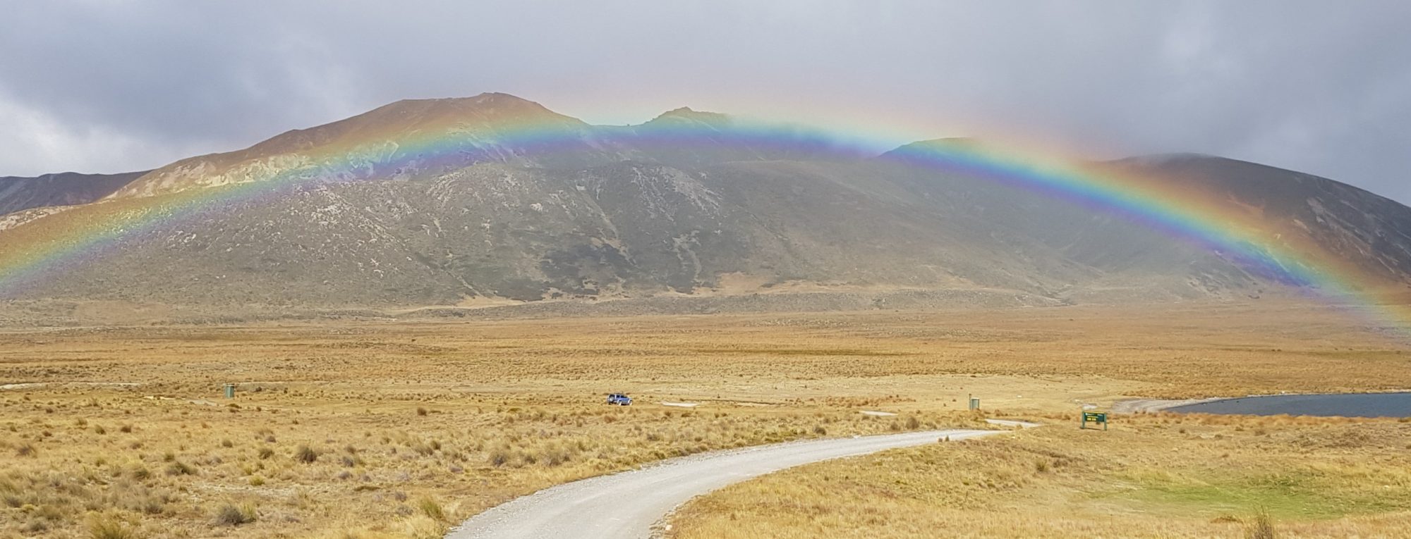
Surmounting this all is one great boulder, from which a superb view is to be had. We had reached the Leith Saddle Lookout.
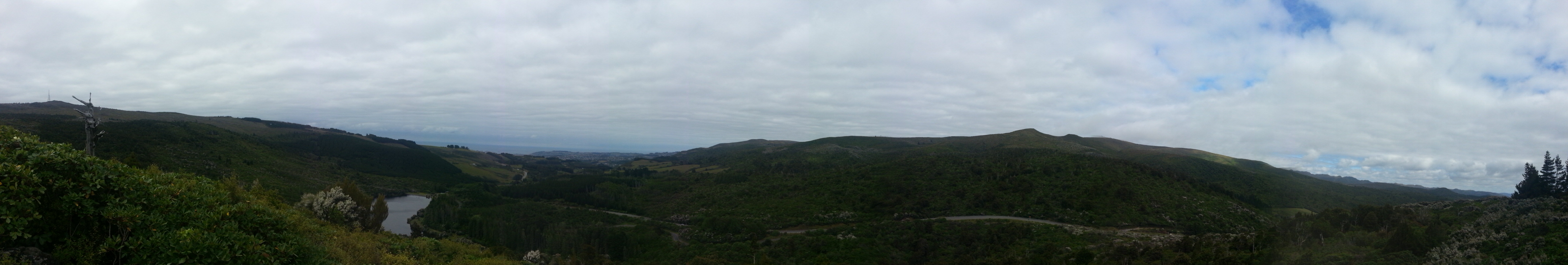
There are two paths leading down from here, but it doesn’t matter which you take as they are both prongs of the same loop. We opted for the leftmost path and began our descent.
Down here there are some lovely old trees, including one huge rimu. Perhaps if we had its measurements we could work out its age?
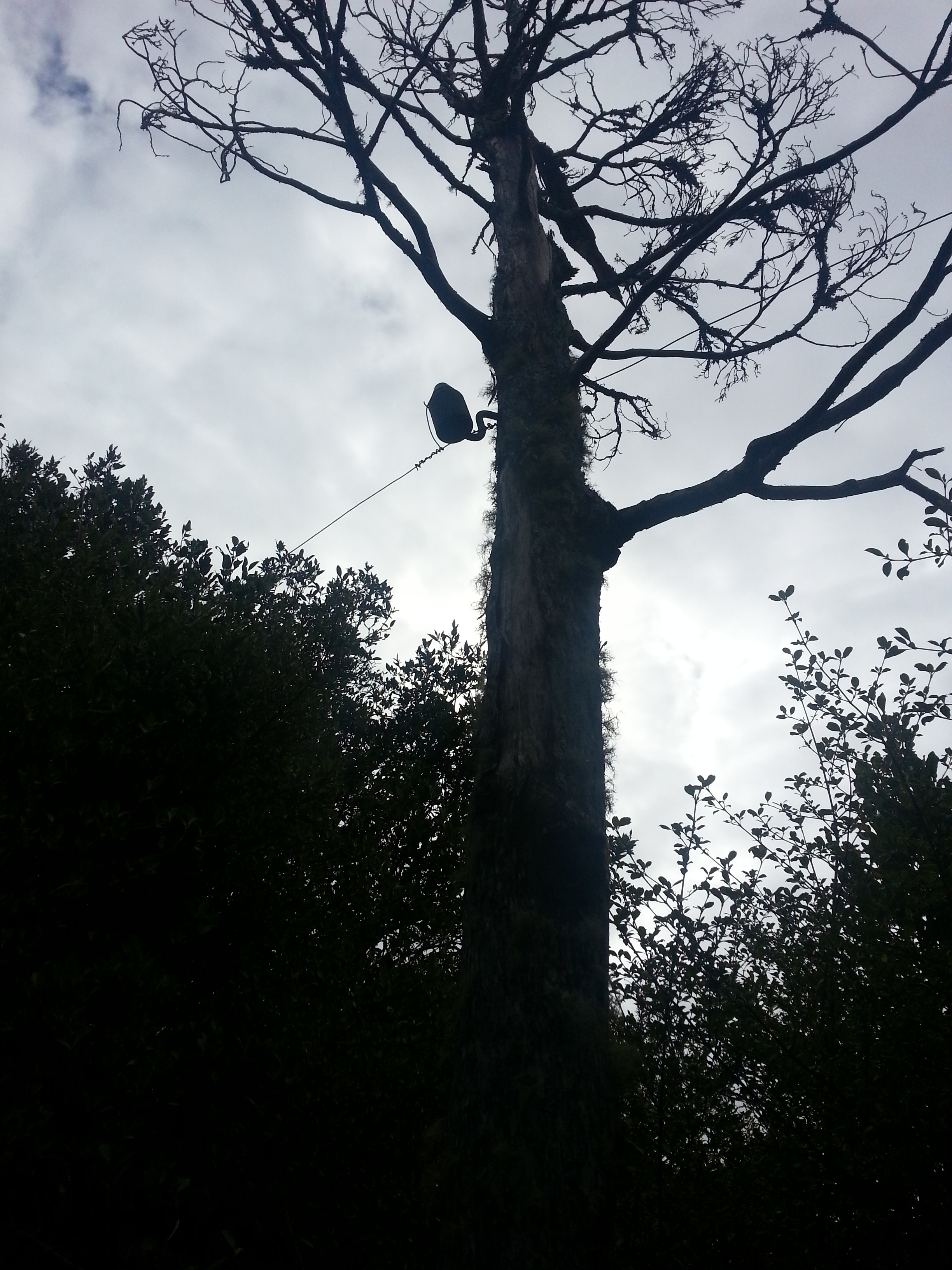
Another thing I noticed was a strange wire attached to a tree. Dad caught up with me as I stopped to consider it and pointed out that it was an old phone line. It certainly matches up with my totally scientific Google image search of old phone wires. I guess this is one of those classic generational markers!
Now we had reached a much more hospitable part of the track – we even had wooden platforms to walk on!

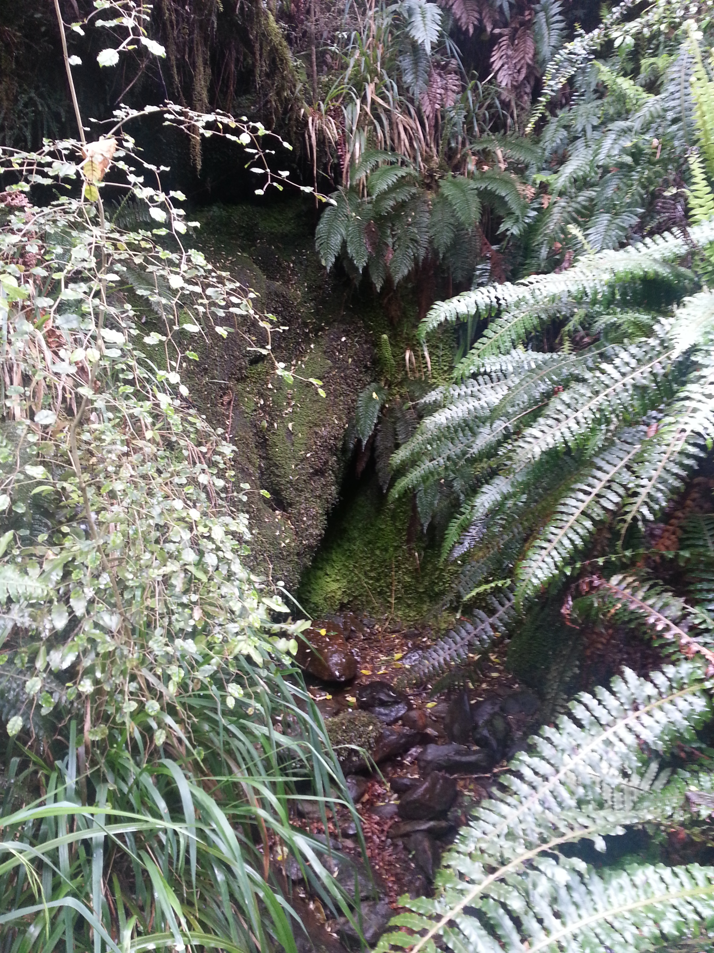
Nearing the end of the track now, we reached a place called Calvert Dell. This is a little waterfall overhung with ferns and festooned in bright green moss.
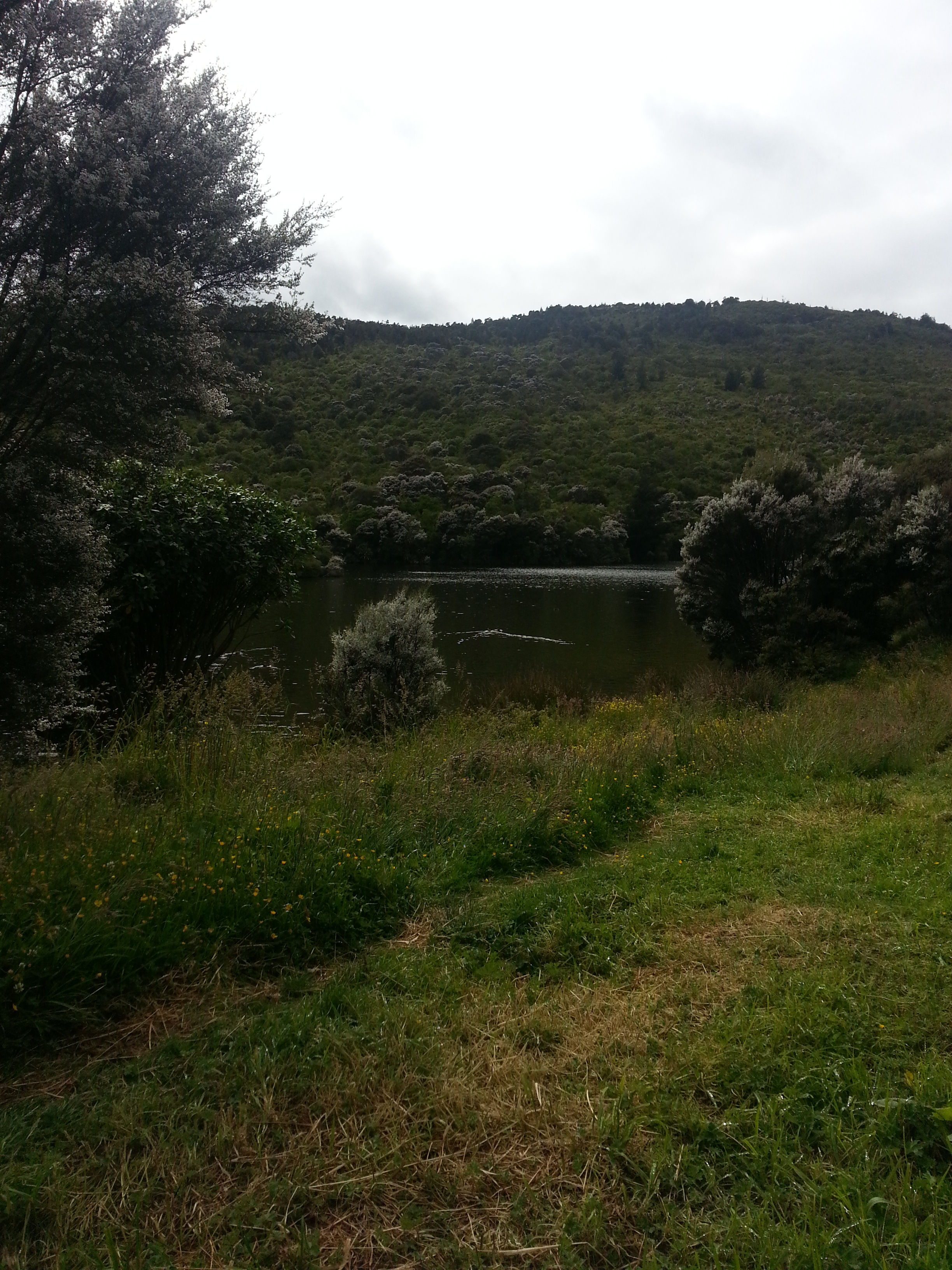
We crossed the bridge by the dell, and soon emerged from the bush over a narrow concrete walkway bridging the artificial channel that runs all the way around the reservoir. I turned back to see the entry was marked by a fearsome warning sign – apparently I’d braved multiple hazards in my journey down the hill.

Heading around the lake, our track ran alongside the concrete channel, which is designed to capture dirty storm water and prevent it from contaminating the drinking water beyond.
The dam here was proposed in 1909 by City Councillor and Chairman of the Water Committee A.J. Sullivan, in order to alleviate the stress on Dunedin’s water supply, which at the time consisted mainly of the Ross Creek Reservoir and the Southern Reservoir. In particular, it was to help supply the hill suburbs. Work began on May 16 1913 and it was officially opened on 15 July 1916. An innovative feature of the design was the fact that water leaving the reservoir was pumped through a pipe over the embankment, rather than piped under, which was considered a source of structural weakness.
A lucky side-effect of the construction of reservoirs is the reservation of the surrounding catchment areas, from which livestock have been banned and thousands of trees have been planted. Thus they also become valuable recreation and conservation areas. As soon as the dam was built, the Otago Acclimatisation Society began work to establish a population of trout, forebears of the Sullivans Dam trout we can fish for today.
We left the lakeside and returned to our car via the gravel Leith Valley Rd, a much less challenging route (but of course not nearly as interesting!). Then it was goodbye to Sullivan’s legacy and back to Dunedin.
References:
SULLIVAN SERVICE DAM. Otago Daily Times , Issue 15833, 4 August 1913, Page 9
ACCLIMATISATION SOCIETY Evening Star , Issue 16151, 27 June 1916, Page 8
Well researched, and a nice bit of local colour! I am, as always, impressed by your continuing intrepidity!
Hi Amanda
Contact me if you are interested
My grand parents were both born and raised in leith valley and there last surviving son still lives in mosgiel
I am fairly sure if he starts to talk of his life there you will have trouble stopping him
The last house my grand parents lived in was at Nichols creek
Hi Vic,
I am always keen to hear some local lore. You can email me at amanda@nunn.nz. I’d love to hear some stories of Leith Valley!
Hi I use to live at the farm at the overpass bridge just before the dam
We made a lot of tracks through the bush around the dam and farm in the 70s/80s as my father was one of the waterboard caretakers for the towns water supply
We were lucky to be aloud to wander through the whole catchment area trapping opposums and checking the wiers
It was a great lifestyle being raised on the farm with soo much wonderful country to explore