I’ve had a nice warm year. I went from a hot New Zealand summer to a sweltering Italian summer and then to one of the hottest UK autumns on record. But my luck seems to have run out, and for once I was facing a grey grizzly day which threatened the approach of winter. But I was in rather a melancholy mood, so I thought a gloomy walk in the grey English countryside would suit me just fine.
Since I’d already done a few sections of the North Downs Way, an old pilgrimage route through the chalk downs of Kent and Surrey, I decided on the 18km section from Wye to Etchinghill near Folkestone. I got off the train in the little village of just under 2300 and immediately crossed the Great Stour River, scanning carefully for fishing possibilities as I went. It was around a ford across this river that Wye was first established, although the main traffic route has long since been moved away.
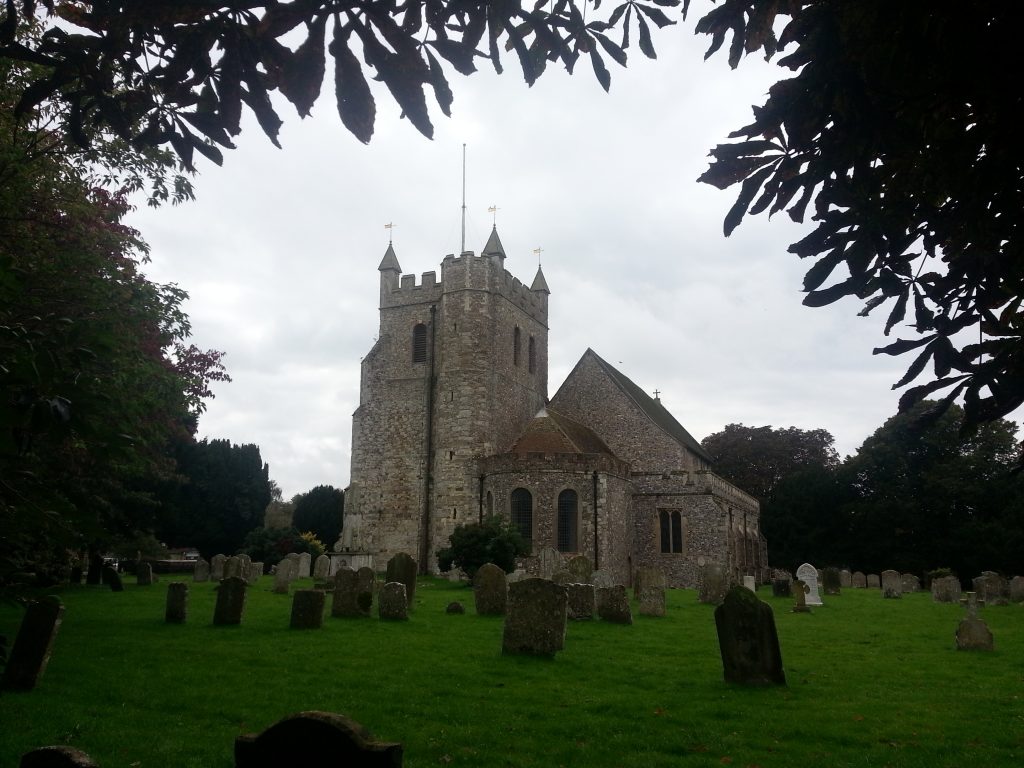
I followed a delicious aroma into the local butcher and acquired a steak and ale pie for later. Then I located the North Downs Way where it passed through the yard of the Wye Church of St Gregory and St Martin. The building dates to the 14th and 18th centuries, with the extremely sturdy tower having been built in 1706 after a lightning strike destroyed the old one – a worrying sign for a holy building.
Nearby is a sign marking the spot where two men were burned at the stake for refusing to renounce Protestantism after Mary I came to the throne and reversed her father Henry VIII’s abandonment of Catholicism.
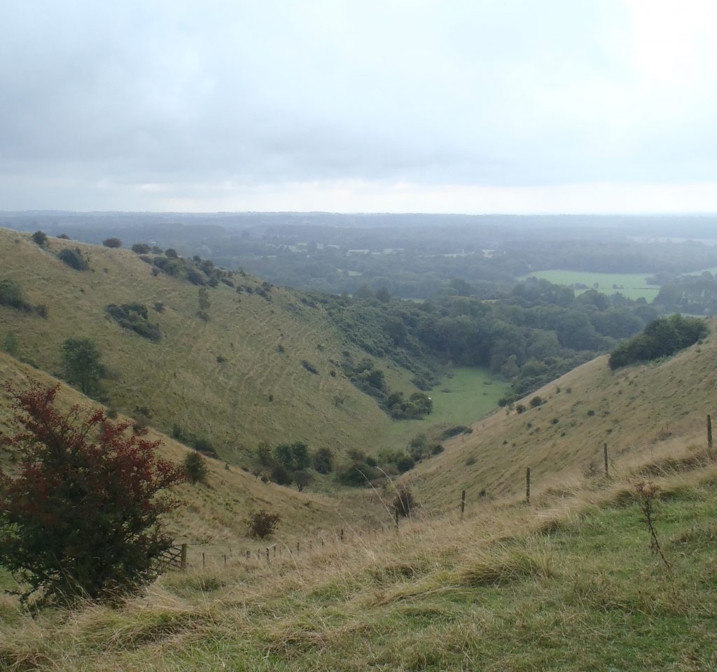
I passed through the cemetery with its higgledy-piggledy headstones and down a narrow lane beside the church garden allotments. Then very soon I was out once again on the chalky downs of Kent. Unlike the parts of the trail I’d previously tackled, this section was hilly and took me through a misty drizzle up into the Wye National Nature Reserve.
Soon I reached the Crown Memorial, an image of a crown carved into the hillside by Wye College students in 1902 to commemorate the coronation of Edward VII. Immediately I realised that my plan to eat my pie while gazing upon the memorial would not work, as it was on the slope downhill from me and not really visible in all its glory. However there was a seat, so I went ahead with lunch anyway.
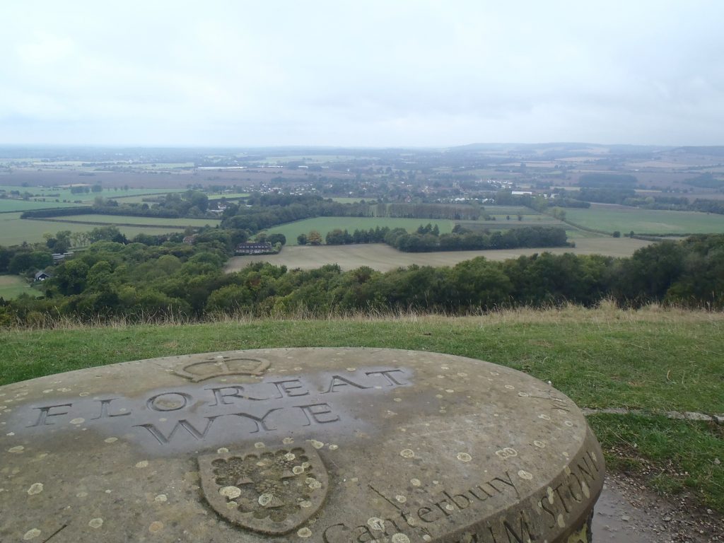
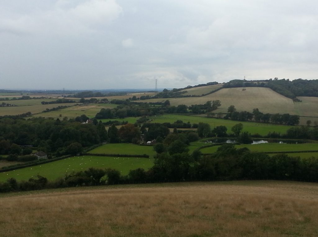
I scarfed the pie while looking down over the village of Wye and over the flat lands below. On a nicer day I might be able to see all the way to the channel from here, but today the most distant object I could make out through the haze was a wind farm. Once finished, I investigated the crown more closely.
Then it was onward along the ridge, feeling almost at home on the close-cropped ridges as my feet squeaked on the wet grass and I passed a group of slightly-miserable sheep huddled together on the slope. I could almost believe I was back on the hills of Otago.
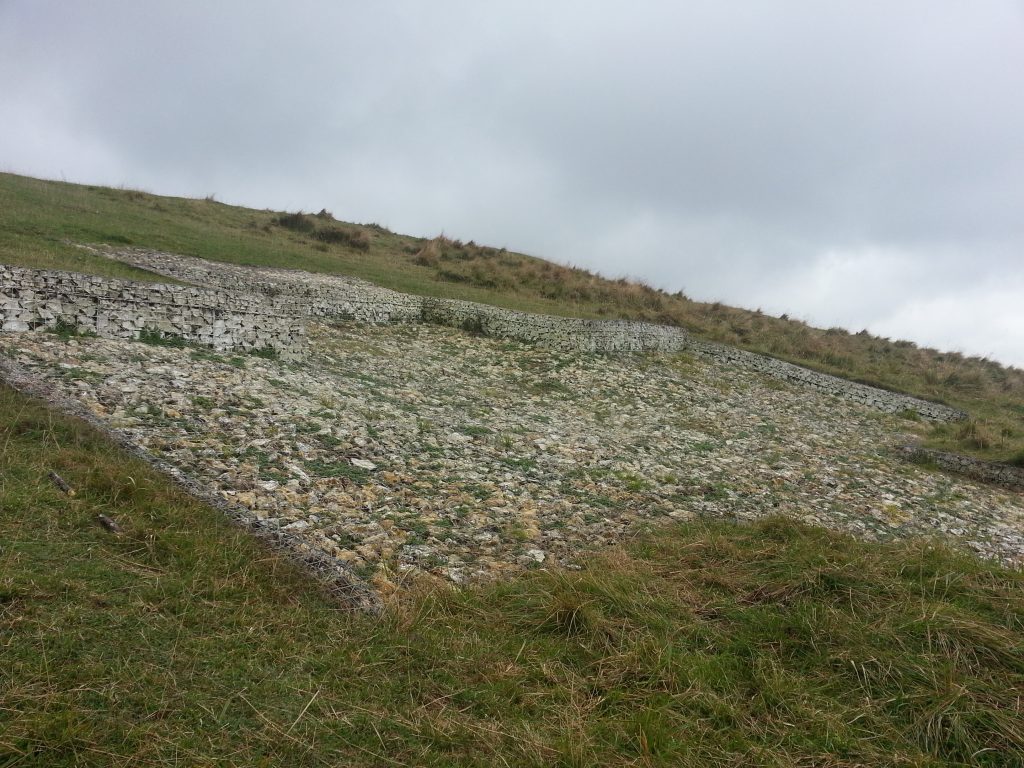
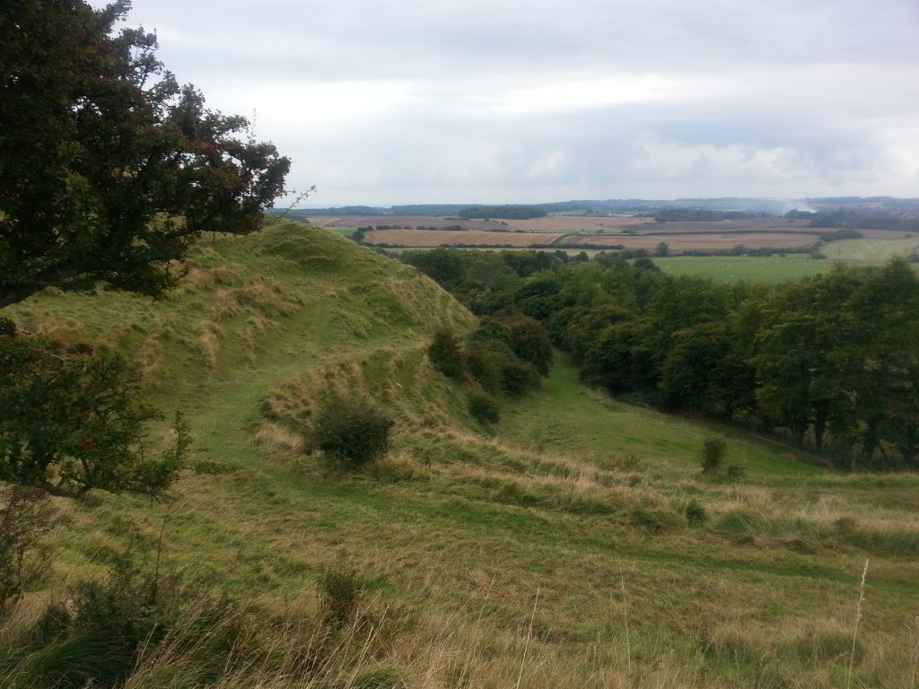
I moved on, to find an even more famous feature of this park – the Devil’s Kneading Trough! This is a narrow coombe (or dry valley) which runs down to the plains below.
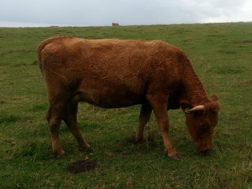
On the fence in front of the coombe a fairly concerning sign was mounted declaring that unexploded ordinance was present in the area, which makes me worry for the poor cows which are employed to graze and maintain this section of the chalk downs.
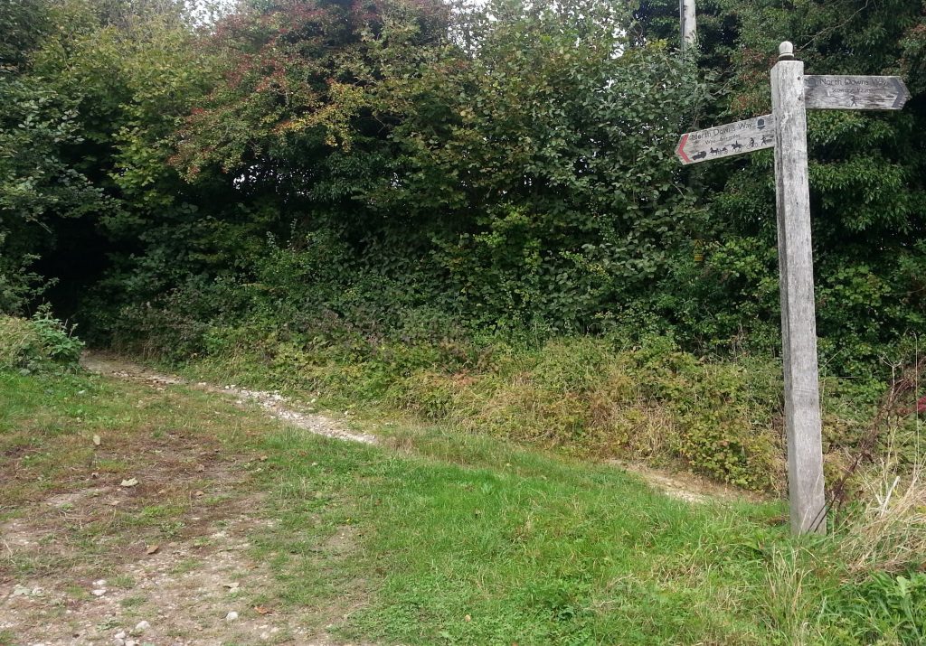
Moving on, I followed the ridge through a farm then proceeded down a long lane between high hedges and then down into a valley until I reached a road called Pilgrims’ Way. I stared at my map long and hard, certain that the name indicated I was still on the correct path, but in fact it seemed I’d missed a turn somewhere. I decided to continue along the road parallel to the actual route and hopefully meet up with the path later.
Atop a nearby hedgegrow, I saw a lucky sign – a red-breasted robin was perched atop, watching me curiously.
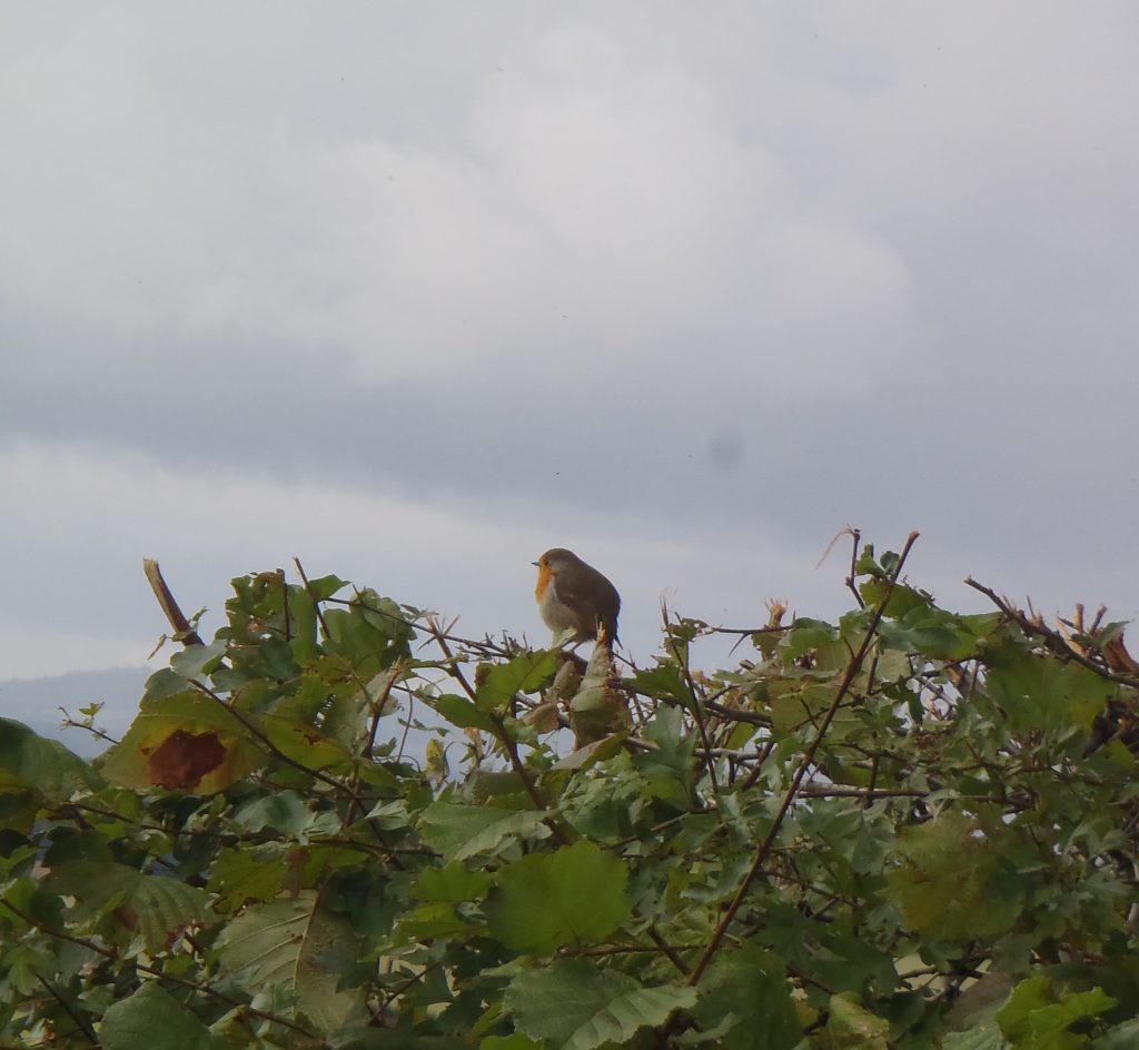
After resting my feet a while I headed down the road. It seems my sighting of the robin was indeed lucky, as I spotted my first ever squirrel up in a tree. Eventually I did meet up with my intended route, just before the small town of Stowting.
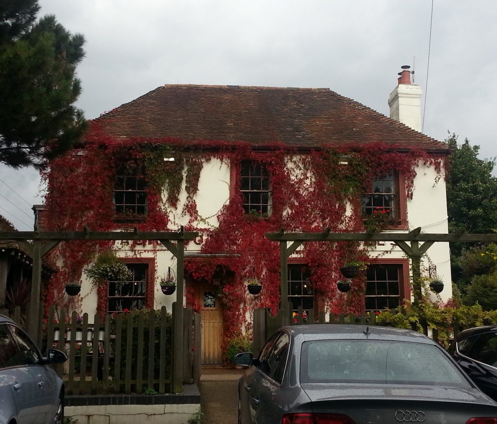
The most prominent feature of this little town is The Tiger Inn, festooned with red ivy and yet another pub that I have been tempted by but failed to stop in to. Because who knows when I’ll let myself get on the road again if I let myself get comfortable with good food and drink? Maybe one day I’ll have to do a “missed pub tour” of the UK.
Passing the Inn, I followed the road through a forest in which I noticed several more squirrels frolicking in the tree tops. Some passing locals gave me the side-eye as I stopped to watch in fascination.
I then had some further trouble locating the trail, but finally managed to find it as it veered up Cobb’s Hill, giving me a good view of the town I’d just passed through as I panted upwards.
Near the peak of the hill I crossed a stile into what appeared to be a mixed wheat and/or corn field. Ahead of me on the path was a gaggle of pheasants, which I tried without success to photograph as they fled ahead of me.
I reached a road, but was directed through a series of paddocks that ran parallel, complete with warning signs that indicated that bulls may be kept on the premises. The only bovine beasts I encountered were clearly cows, but that didn’t help much because I’m always nervous around cows. I’m convinced that one day they will figure out that they are larger, stronger, and clearly outnumber me, and I will end up the first victim in the great bovine uprising. These cows showed absolutely no concern at my passage, probably the first sign that they are plotting the downfall of humanity.
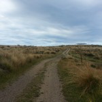
Then I plunged into a valley above the village of Postling, ultimately cresting another ridge and passing the town by completely and bringing me back up onto another hill.
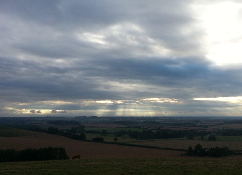
It was starting to get late in the afternoon since I’d been taking it easy in the hopes of avoiding sore feet and fatigue. It seemed to be working as I was still feeling pretty fresh even after five hours on the move. As a bonus, I got to see some amazing afternoon light patterns over the downs.
I passed a communications tower of some sort and found myself face to face with an alarming array of warning signs. Apparently the track runs directly through a military training zone. Most concerning of all, I was advised not to touch strange objects, as “they may explode and kill you”. I understand that protecting public byways is a big deal in England…but maybe there are some places that the general public should not be wandering through?
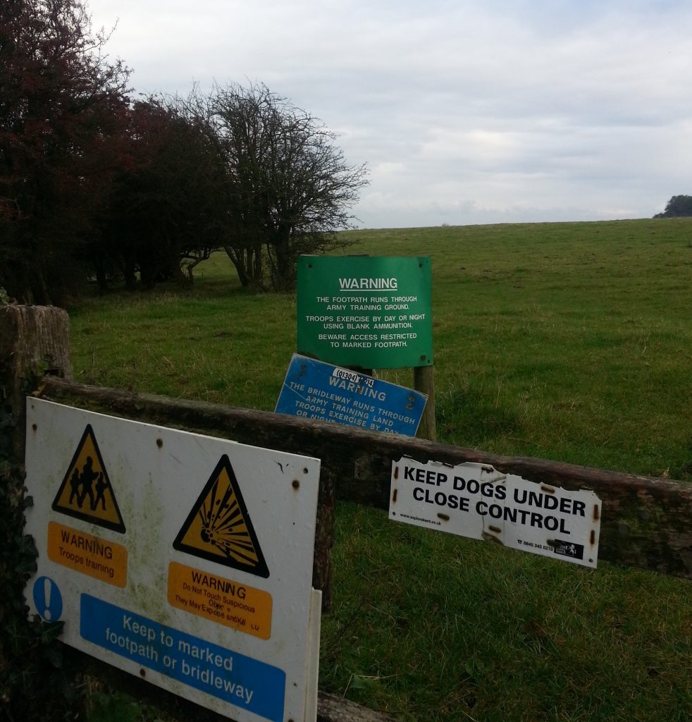
As I passed through the terrifying field I spotted some tasty-looking mushrooms which I would have harvested if not for the possibility they might explode and kill me.
I managed to make it out the other side with all my limbs intact and here met the road into Etchinghill, the end of my planned adventure for the day.
But…I didn’t feel tired and nor were my feet particularly sore. Folkestone didn’t seem far away as per the map, and it was only 5pm. Surely I could make it to Folkestone and catch the train home from there?
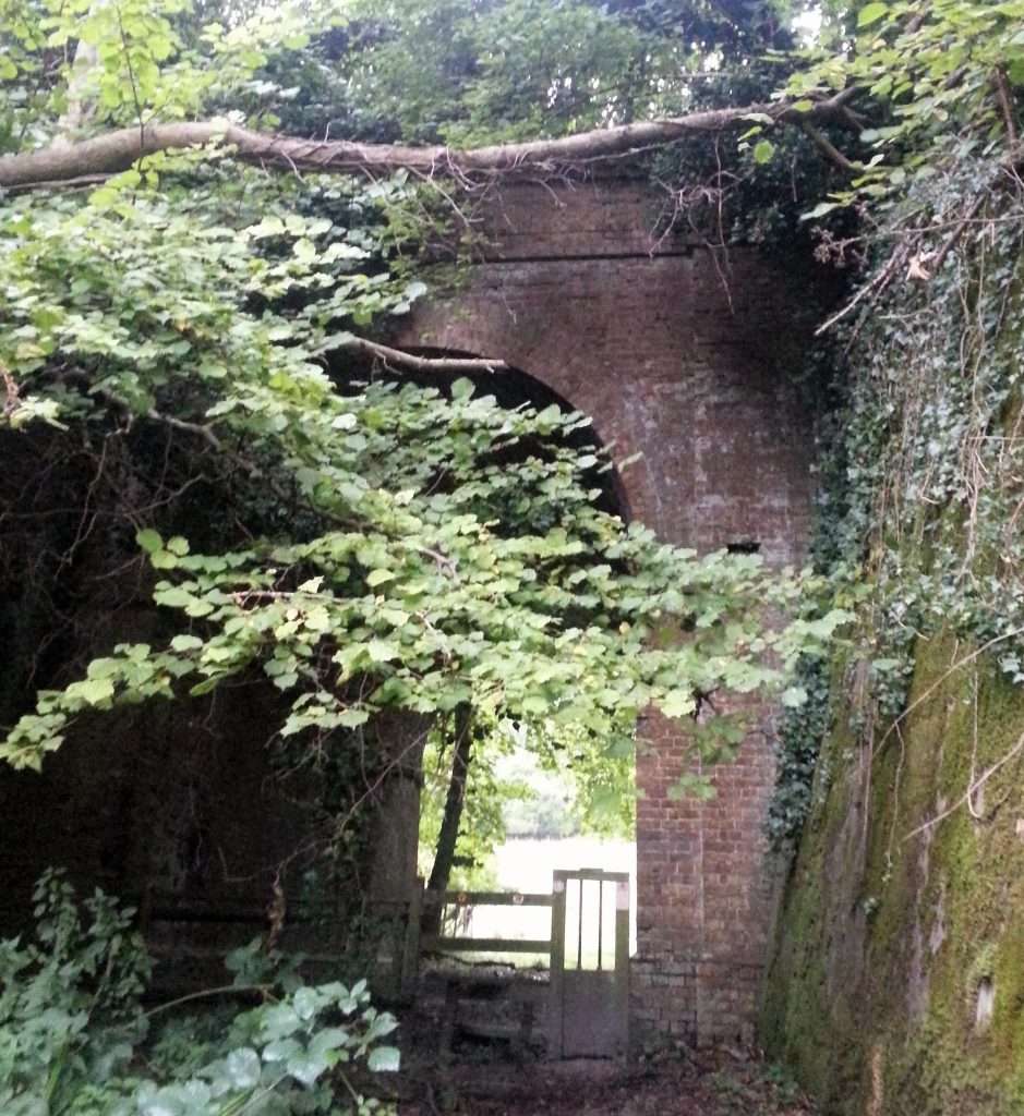
I texted my landlady to let her know I’d be late and probably take dinner in Folkestone so not to worry about me. Then I crossed the road, turned left at the gate to Coombe Farm and headed into a small patch of wood at the bottom of another valley. Here I passed under the disused Elham Valley Railway line which once connected Folkestone and Canterbury. It was abandoned in 1947 and the Channel Tunnel Terminal now covers part of it.
Then up another coombe I went, on to the ridge of hills above Folkestone. As sunset turned the sky orange behind me, the ocean came into view and the lights of the town ahead of me started to come on. Soon I came to a lookout overlooking the Channel Tunnel Terminal and reflected that this was the perfect time to see it as it was lit up spectacularly in the fading light.
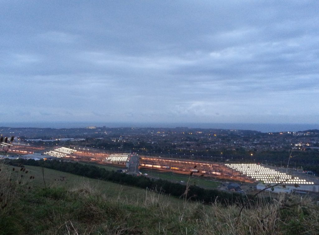
There was only one problem: the North Downs Way actually bypasses Folkestone and would take me on to the route to Dover if I kept following it. I’d been assuming I’d be able to find another byway which would take me down to town, but this enormous terminal was firmly in the way. And now it was getting a bit dark to improvise a way down the steep hill. So I had no choice but to keep following the ridge, hoping I’d be able to find a safe way down.
Lucky for me I had a torch in my bag, because once darkness came, it came quickly. I had now run out of map since I’d only saved enough to get me to Etchinghill, and I was in an unknown field in the pitch dark. I wasn’t even sure I was still on the North Downs Way. Still I soldiered on towards some distant lights and found myself atop the hill under which the A20 motorway tunnel runs. My only option was to continue, even though to my chagrin I could see I had almost entirely passed Folkestone.
Finally, starving, exhausted and aching from shoulders to feet, I hobbled on to the A260. At least I knew where I was now, even though I’d come a long way out of my way and in fact was now on the route I’d taken from Dover to Folkestone. My plan to take dinner in town was scuppered as it was so late and I was worried that if I stopped I’d never make it to the train station.
With grim determination I slogged the final three kilometres to the station. In my first bit of luck since passing Etchinghill, I was just in time for the 8.30 train back to Dover.
The next day I spent soaking my feet in a foot bath and cringing every time I moved and set off a cacophony of aches and pains. This was truly the furthest I have ever walked in my life, and I wasn’t keen to repeat the experience any time soon. I had learned the hard way that sometimes places aren’t as easy to walk to as they might seem.
On the plus side, I was no longer worrying about a bad mood.
References:
Wye, St. Gregory and St. Martin’s Church by David Ross