It was day two of our Wellness Walkers jaunt to Queenstown and we came together after our various Saturday adventures in order to embark on an ambitious walk – the 6-hour tramp to Lake Rere, tucked away in its own private valley just south of the confluence of the Greenstone and Caples Rivers.
The walk was actually my suggestion, as Dad and I had done it in February 2015 – at my insistence, as I desired to catch one of the fabled golden brown trout that inhabited the lake. Alas, I was unsuccessful, ironically catching instead a large trout from the bridge only a minute from the car park.
After completing the challenging walk, which pushed the limits of our abilities, Dad expressed a wish to try it again once he turned 70. Coincidentally, he was turning 70 near the time of our trip, and I seized the opportunity to make it happen.
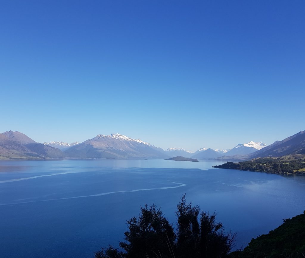
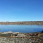
The six of us clambered into our vehicle and set off along the narrow twisting road leading north along the lake shore from the popular resort town. One of our party soon became ill from the constant weaving about, so we were forced to pull up at the lookout for a break – with only the mediocre mountain view to entertain us.
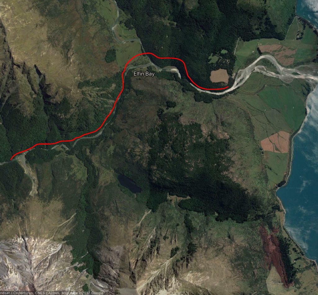
Feeling better, we embarked once again, passing Glenorchy and carefully crossing the one way bridge at the Rees River. Skirting Mt Alfred, we found ourselves on a straight stretch traversing the Dart River valley, strange grassy mounds populating the fields on either side or us.
These are The Hillocks, and had I been on the other side of the world I might have taken them for barrows or some other kind of neolithic structure. But man’s foot did not tread these lands until less than a thousand years ago, so we needed to come up with an alternate explanation.
The prevailing theory is that the mounds are piles of debris left behind from the ice age glacier that carved out this valley, and they have been protected as a near-perfect example of such.
However more recent analysis suggests they may be deposits from an enormous landslide which occurred after the glacier had already retreated. The source of the alleged slip in the Humboldt Mountains to the west has even been identified, though I’ll have to go back some time to see for myself as I wasn’t aware of this interpretation at the time. Good excuse for another holiday.
After passing the Dart River, the paved road ran out, and we bounced southward along the western shore of Wakatipu. After a brief respite at Kinloch, we again plunged into the wilderness, crossing three fords before arriving at the Greenstone car park.
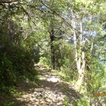
Here we met the final member of our party and donned our packs for the mission ahead. Once appropriately provisioned, we headed into the beeches where we were very shortly presented with a choice – take the loop clockwise across the Greenstone River stock bridge and over farmland, or anticlockwise through the forest.
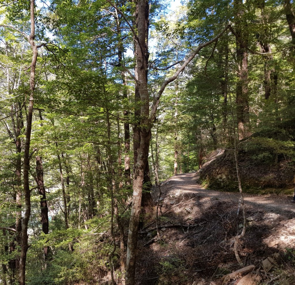
I suggested we take the longer forested path to start with, meaning that the we’d take the steepest section of the track downhill. The others agreed, and we set off along the gently rising path.
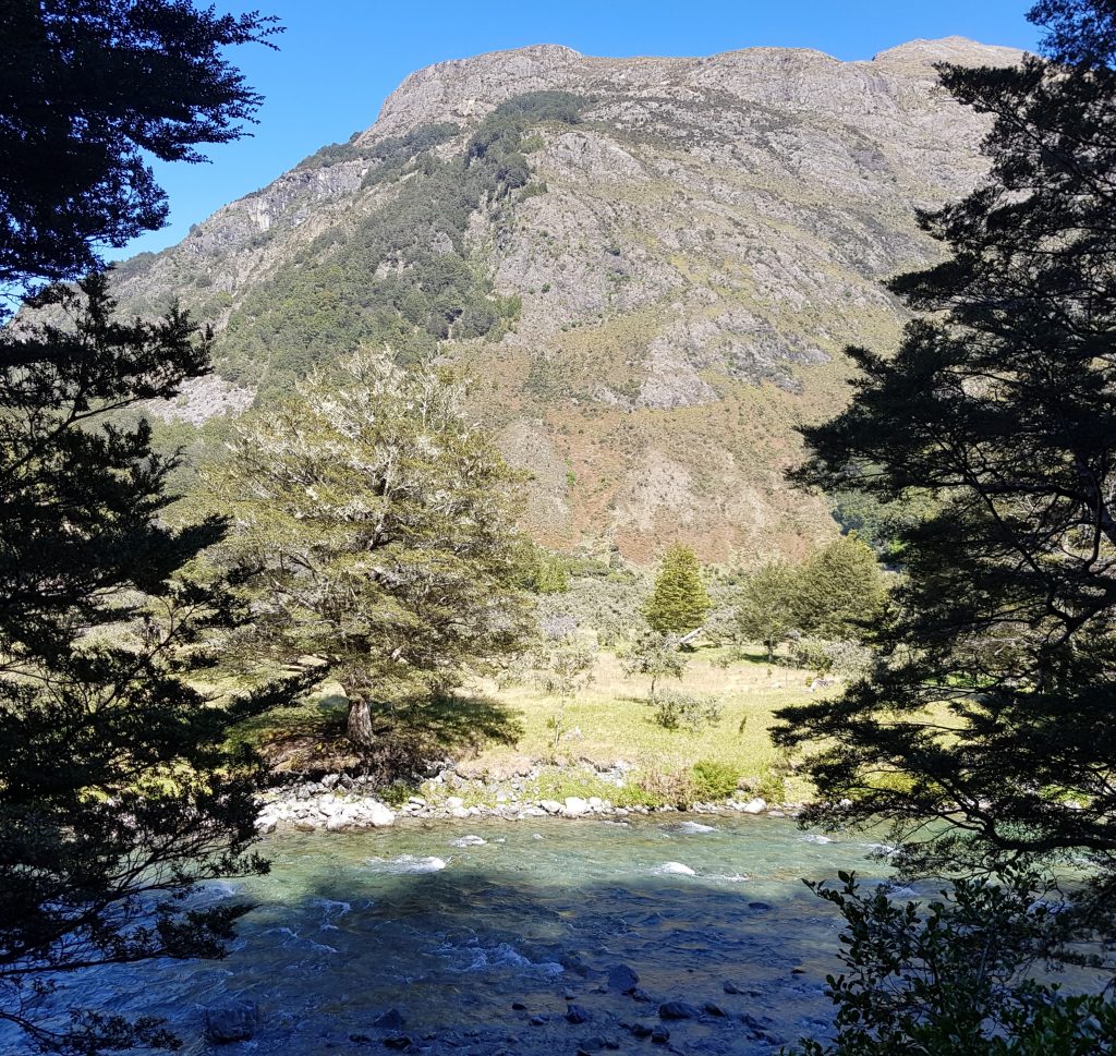
Our route overlooked the Greenstone River, magnificent crystal water refracting shades of deep blue and green. Very soon we came upon a sign introducing us to Ka Whenua Roimata, the Land of Tears.
To understand this, we must look back to the earliest interactions between Europeans and the Ngāi Tahu, in whose territory this land was to be found. In 1844 the government purchased approximately 80% of the South Island from the tribe, making certain promises to set aside reserves for Maori use and to build schools and hospitals.
Almost immediately the government failed to live up to its end of the bargain, with Ngāi Tahu’s first complaint being registered in 1849. All attempts to secure justice were stonewalled for the next 140 years, resulting in poverty and alienation for the Ngāi Tahu, who were unable to participate in the farming economy due to lack of land and did not receive adequate education or medical care.
The Greenstone, Elfin Bay and Routeburn high country stations were purchased from private owners by the government in the early 1990s in order to reserve them for a possible settlement under the Waitangi Tribunal, which was the first serious effort to put things right. The thought of these treasures of New Zealand beauty returning to Ngāi Tahu hands made some uneasy, worrying that the public would lose access – how the tables turn!
Ngāi Tahu pledged to permanently lease the majority of this area to the Department of Conservation at a nominal fee, and to gift the mountain peaks on the property to the entire nation. It was those peaks that were named Ka Whenua Roimata, in memory of the long struggle for justice.
Unlike the Crown, Ngāi Tahu kept their promises.
The remaining commercial activities on the three stations are still managed by the same family as before the settlement, who work the remote unforgiving region mainly from horseback, and the annual sheep muster involves driving the flock across the narrow stock bridge we glimpsed earlier.
I drank in the beech forest as we continued alongside the river – how different from my usual forested haunts of Mount Cargill and Leith Valley! Our path was dry and light and airy, nothing like my accustomed damp jungle.
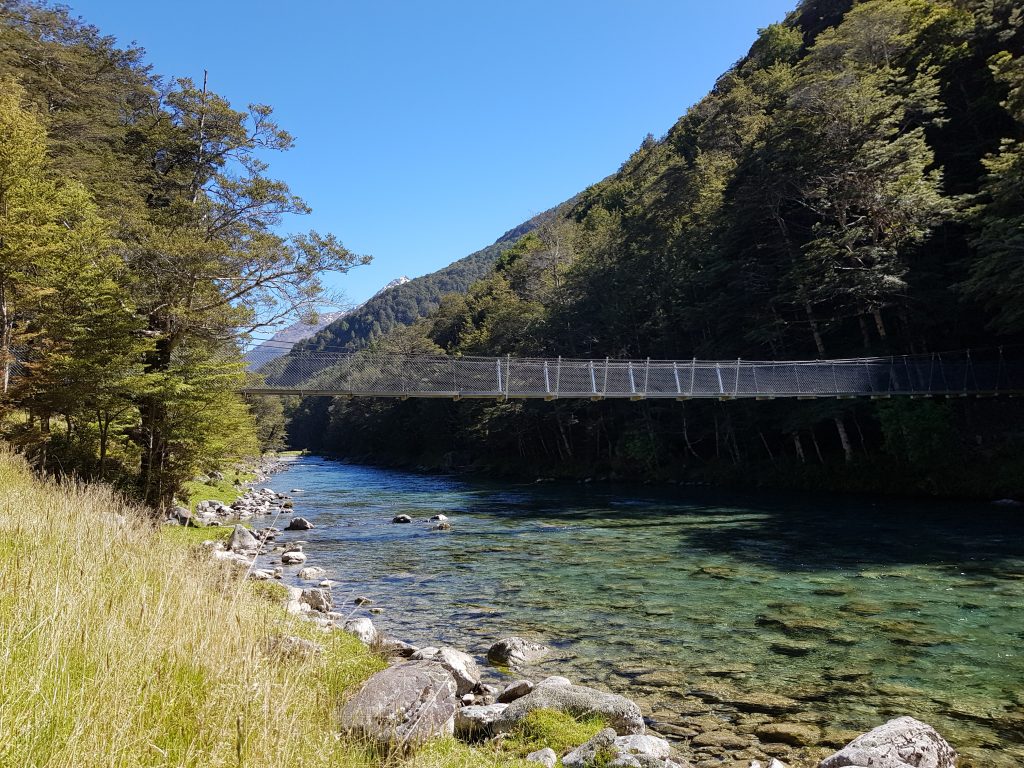
Passing the confluence of the two rivers, we soon came to a bridge over the crystalline Caples, which brought us on to the flat valley floor, cloaked in dry yellow grass and matagouri.
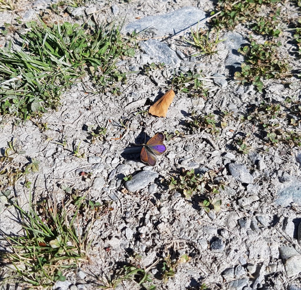
Our path through the field scattered a flight of tiny butterflies – boulder coppers – whose larvae feed on muehlenbeckia. The females have orange and black patterned wings while the males feature an iridescent purple sheen.
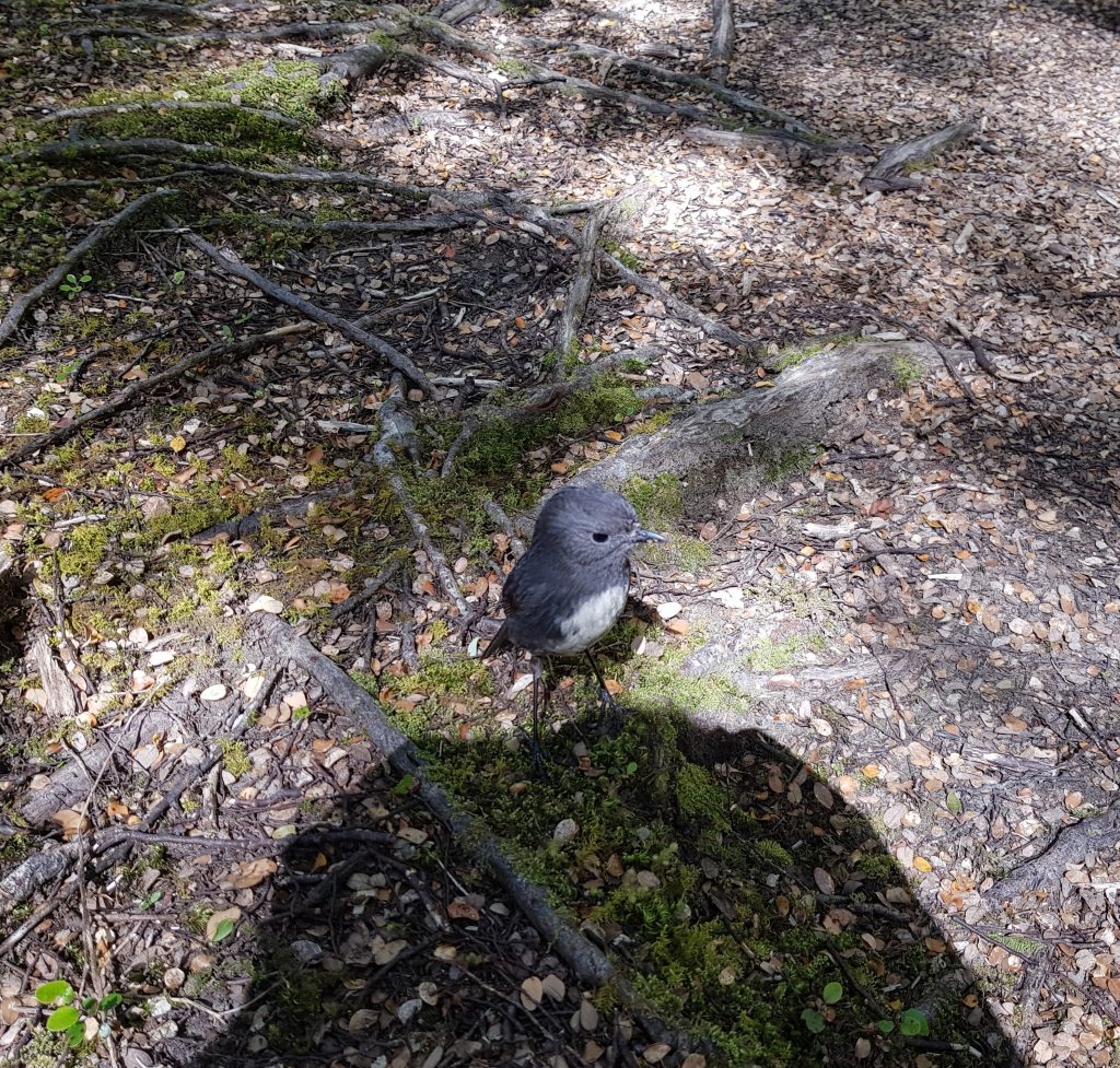
In the trees once again, we paused to meet a new friend. A fearless toutouwai (New Zealand robin) appeared to check out the group of strangers galumphing through its forest. As best I could tell this one was a male – far more common than females in areas with high numbers of introduced predators, as the females are vulnerable while nesting. Hopefully in this case it was just a coincidence and not because the population is under pressure.
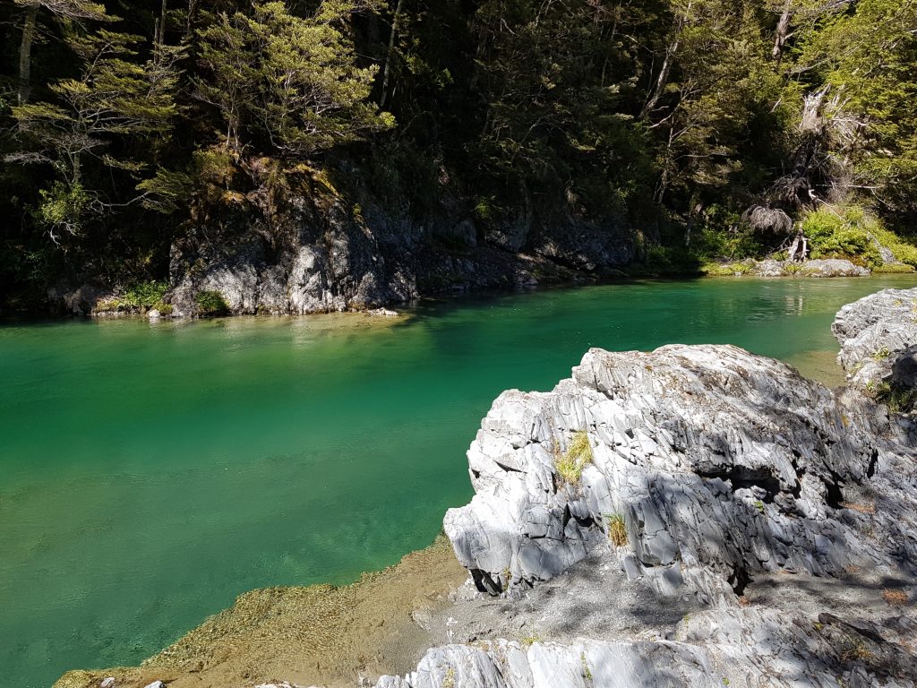
Moving on, we finally found a spot where we could easily access the magnificent Greenstone River. It was certainly worth the wait to perch on the warm rocks and gaze into the deep green pools. We took the opportunity to pose for many photos.
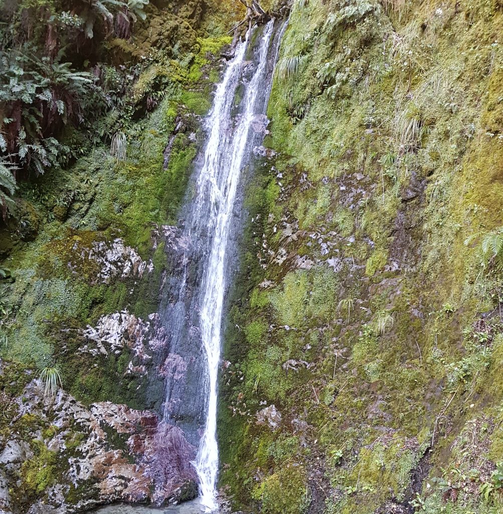
As much as we’d have liked to linger all day, Lake Rere still awaited. Moving on, we passed two waterfalls tucked away in the mossy nooks of the gorge.
Eventually we came to the place where the Greenstone track and the Lake Rere walk diverged. Not yet ready to take on the four day hike of the Greenstone-Caples loop, we headed down the zig-zag toward the bridge below.
Crossing this bridge would take us to the other side of the valley, into a favourite haunt of Victorian ramblers and pleasure-seekers.
So what better place to pause our story than on the boundary of two worlds. Today we learned the sorrows of this land, and next time we shall learn of the joys.
References:
Wakatipu Gems – Fish & Game New Zealand
Evidence for a rock-avalanche origin for ‘The Hillocks’ “moraine”, Otago, New Zealand by S.T. McColl, T.R. Davies
I can’t wait for episode 2!!