Previously, I have documented the various abandoned farmsteads to be found on Otago Peninsula’s Paradise Track, a project which took me three posts to cover entirely. First, I encountered the ruin of Donaldson’s Hotel before continuing down to the Sanderson farm, where we discovered victims of the First World War and of the Spanish Flu epidemic that followed. Then we meandered on down to Paradise Farm and finally found our way to the rickety brick ruin of Beattie’s Springbank homestead.
But as I slowly made my way back up the hill from Boulder Beach, I happened to glance across the valley to the west. That way lies the Buskin track, and I noted three more macrocarpa clusters dotting the way. The Beattie, Lee and Sanderson families would have been able to look across that way too, and perhaps these tree clumps once represented the homes of their neighbours across the way.
I knew then that my work was not yet over. I would have to return and investigate the Buskin Track, just as I had done for the Paradise Track.
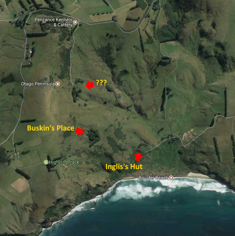
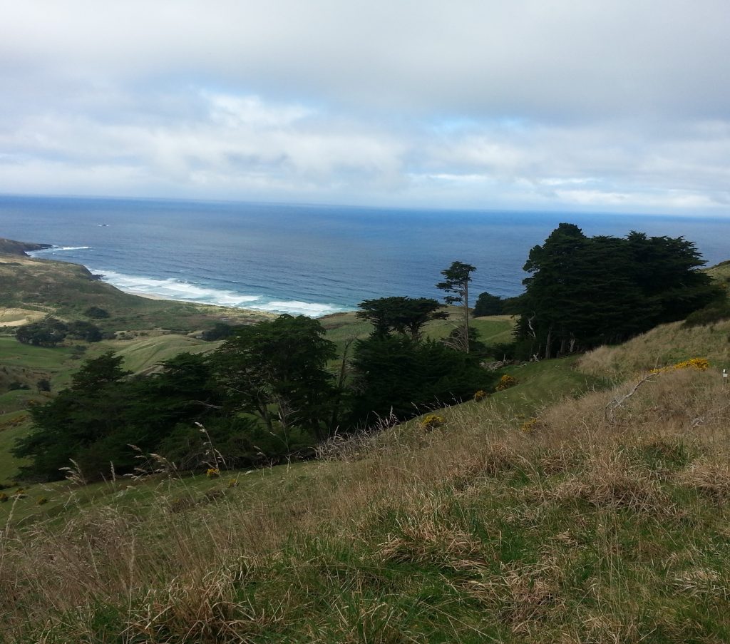
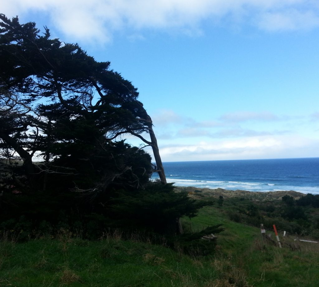
Accordingly Dad and I set out on another somewhat iffy day, though the warmth of spring was beginning to make itself felt. We parked at the Buskin Rd track head by the kennels, triggering a cacophony of barking. We quickly made our way down past the still-occupied home at the top of the hill, and were greeted by a view of our three targets and Boulder Beach below.
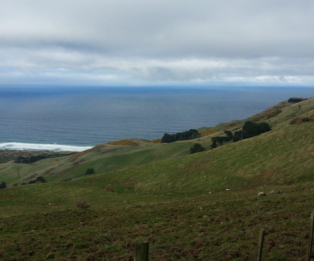
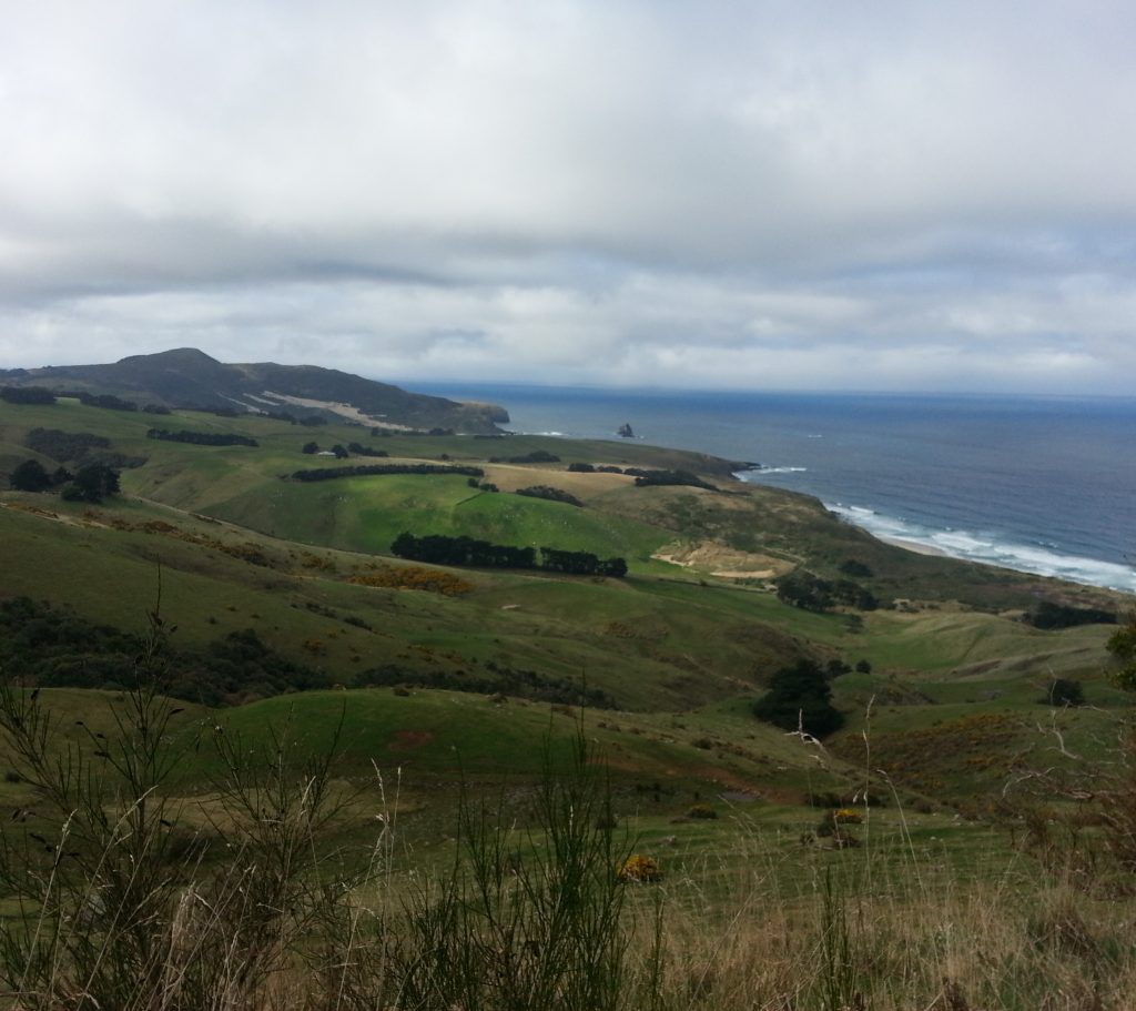
As we picked our way down the ridge, doing our best to avoid the churned up muddy patches trampled by cattle, the view opened up to the north. The dunes of Sandymount were visible in the far distance, and in the middle distance was Paradise Farm, with the Sandersons above and Beattie below.
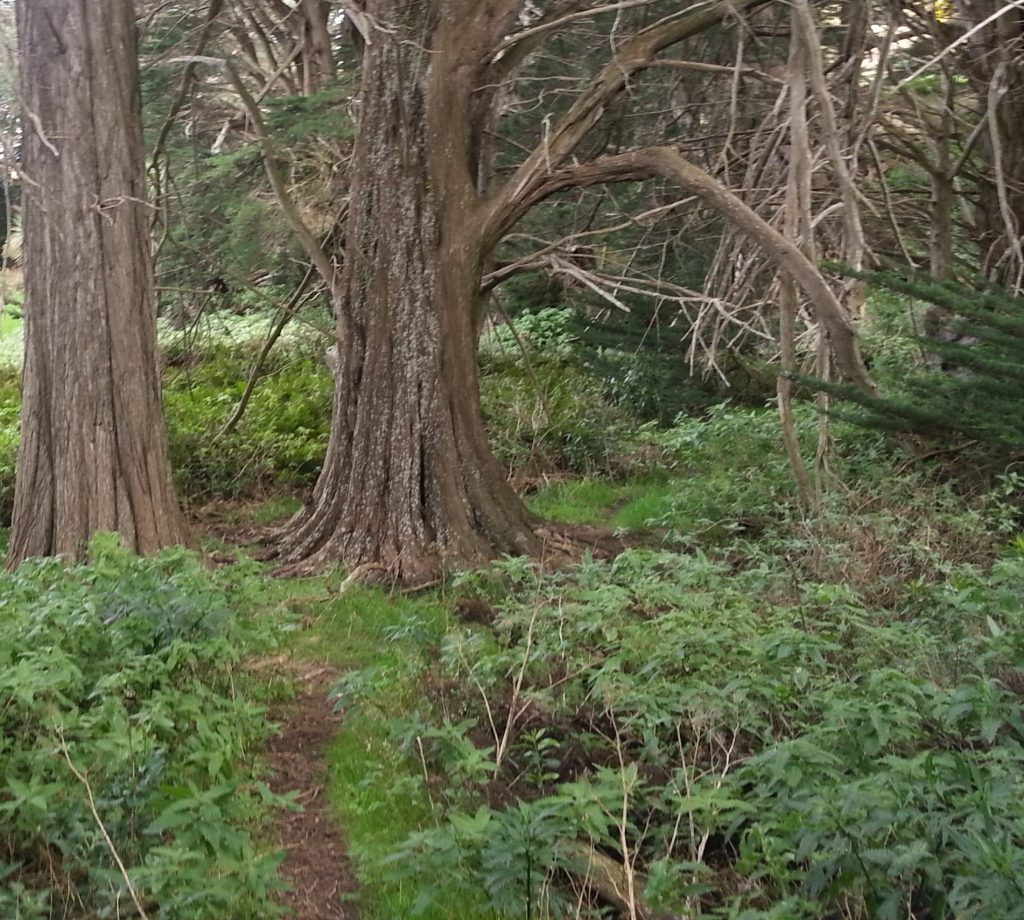
Soon we came upon our first point of interest, a huddle of weathered macrocarpas straddling the track. This clump of trees presents an intriguing mystery, because while the trusty 1901 W.T. Neill map of the Peninsula shows two buildings here, it neglects to name them. Thinking I might be able to track down the owner by looking up the block number of the section, I consulted the 1863 surveyor’s map only to find a large chunk of land below Highcliff Rd marked only as “Part of 2842-2843-2844-2855”, which meant nothing to me. None of the buildings inside this boundary are marked on the map, besides the Highcliff School and Post Office.
But schools tend to have documented history, and indeed I soon discovered that the Highcliff School was built in 1871 with land bought from one William Shand, apparently the second largest land-holder on the Peninsula before Larnach’s great purchasing spree. From there it was easy to find an advertisement offering leases on the “Shand Estate at Highcliff” which was composed of at least five farms ranging from 20 to 37 acres. Digging deeper I finally found my mystery numbers: they represented applications for land received by Dunedin’s Land Office in 1859. The submitter of those claims? You guessed it: William Shand.
There were three Shand brothers and a sister who came to Otago from Inverurie in Scotland. The first, James, died soon after his arrival but his widow Barbara was well respected in the Green Island district. George and his sister took up the “Keith Hall” estate on the Taieri. William, the last, arrived on the George Canning in 1857. He was a baker by trade but came with money and was soon a wealthy land owner. I believe this is our William, though I could be wrong as hand-me-down names ran strong in this family and the William we are looking for could just as easily be a son of any of the three brothers.
After all that effort you’d think I’d be somewhat closer to figuring out who, if anyone, lived here, but you’d be wrong. William did not live on the Peninsula, and leased this land out to be developed by tenants who typically held leases of ten years or more.
So who were the toiling tenants of Shand’s estate, those poor people practically obliterated from Peninsula history because they never made it on to the map? I can only hazard some intriguing guesses. Perhaps Crawford, the name given to the creek that runs through the estate, gives a clue. Then there are the Jury, Black and Sproule families who intermarried with the Beatties and appeared often in the Highcliff School roll but do not appear on the Neill map. Or my favourite, the Townley family who also attended Highcliff School, lived somewhere nearby, and were involved in considerable trouble in the neighbourhood.
But we had best move on before we get bogged down both literally in the mud and figuratively in the details.
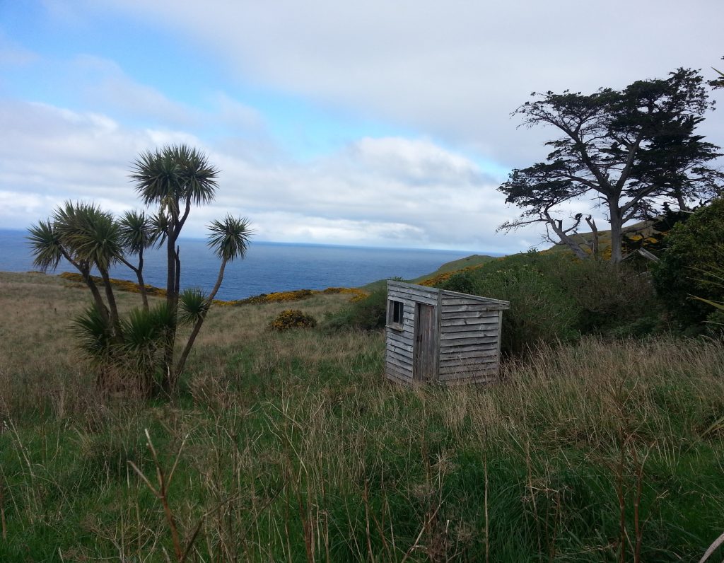
Forward to our next target – Buskin’s place, for which this track is named. From above, all that is evident is a tangle of trees and a tiny weathered wooden shed nearby.
William Buskin was an Englishman born in 1822, probably somewhere near Exeter. He married Mary Ann Pile in 1844 and from there things get murky. The next sign I found of his family was Mary Ann and two children aboard the George Canning – fellow passengers of William Shand and family. I’m not sure where William (Buskin) was – perhaps he was already in New Zealand, having scouted ahead. Intriguingly, his second son Lewis, born 1849, was apparently born in Canada.
In 1863 William purchased this Peninsula block of land and also several sections on Maclaggan St. The Maclaggan St property contained a boarding house that became known as Exeter House, and several smaller cottages, which must have brought in a fairly decent income for the family.
William had a roller-coaster of a year in 1866, with Mary Ann passing away early on. He lost no time in remarrying, to Mary Ann Morley, and their only child Alfred was born that year. Alas, the baby lived only two months.
William’s luck did not improve in 1867 when he made a boat trip with his 21-year-old son Levi to Seal Point, mooring in a small harbour there to collect shingles. A huge wave rolled in, dragging Levi into the depths. William managed to cling to shore, and it seems that Levi’s body was never found.
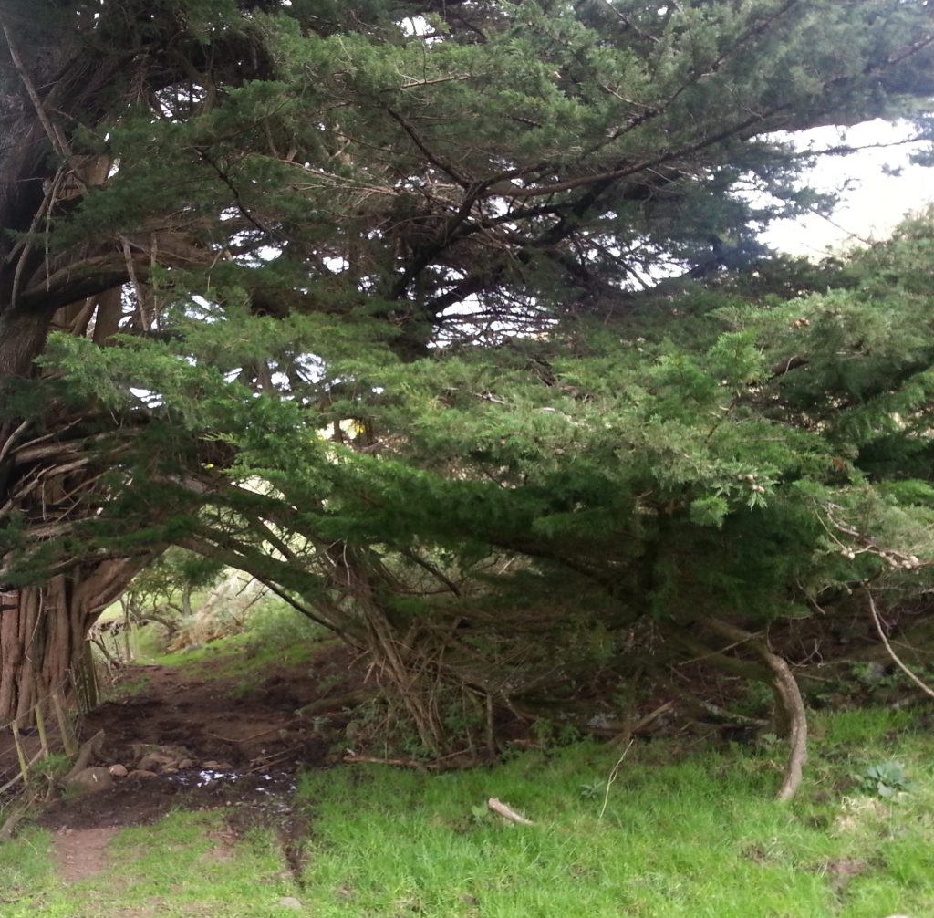
After inspecting the lonely shed, which was unlocked but empty, and peering out of its single window, I delved into the trees. What I discovered was a thicket of native stinging nettles with a narrow path running through, and the only marker of past habitation was a single broken brick embedded in the soil.
William did not take the 1880s Russian scare lying down. When the guns for our new fortifications arrived from England, he took the opportunity to measure them in order to invent a carriage upon which they could be transported. Unfortunately the man he hired to secure his patent turned out to be a charlatan and disappeared with his money, a matter the incensed William took all the way to the colonial secretary. He also attempted to interest the Industrial Association with his “Improvements in Wheeled Vehicles”, though they did not seem particularly keen enthused about his offer to allow them to produce a hundred sets of his reinvented wheels.
Seems William was quite the mad inventor, getting in trouble at least once while “driving a composite vehicle answering somewhat to the description of a buggy”. His horse bolted, the vehicle crashed into a pole and immediately disintegrated, and his wife received a gash to the face. Luckily the injury was not serious.
Lewis, his Canadian-born son, passed away in 1884 at the age of 35. Out of five children, including one stillbirth, William would outlive all but one. The only survivor, Albert, would live to the (comparatively) ripe old age of 62.
William died in 1888, while Mary Ann (the second) continued to run the Maclaggan St boarding house, which was only sold along with the associated properties after her death in 1909. As for the farm, I’m not sure, but I do know I’d better move on to site number three.
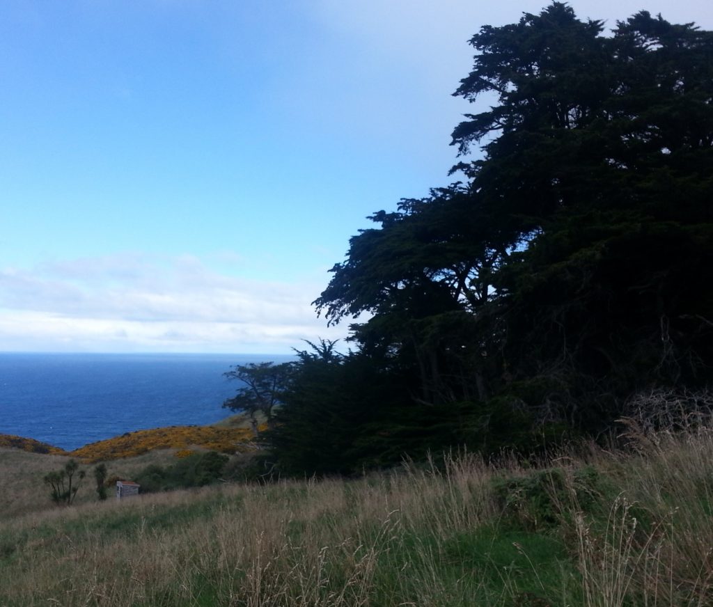
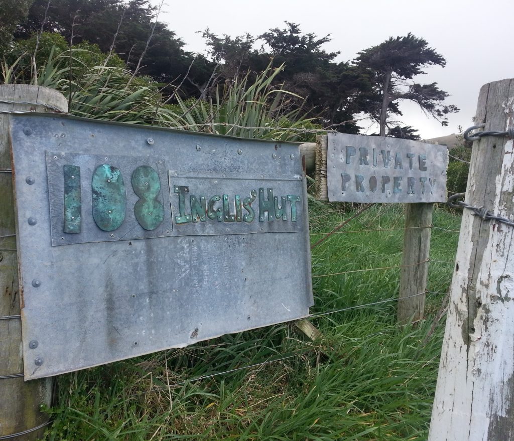
I backed out of Buskin’s nettly grove and headed further down the hill where the Inglis farm windbreak gave me a fair idea of the prevailing wind conditions of the area.
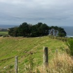
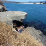
Robert Fleming Inglis purchased this land from James Beattie, and as I rounded the row of bowed macrocarpa I discovered to my surprise that more than trees remain on this site!
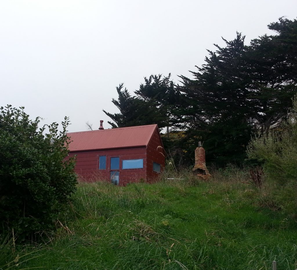
Without intruding over the property boundary I was only able to get a distant glimpse of the hut with ruined chimney beside. I wonder whether the hut that stands today was built by the original settler, or later on.
I couldn’t find a lot of information about Robert Inglis, although that may be just as well or else this post might ramble on forever. Judging by the birthplaces of his children it appears he arrived here sometime in the early 1860s from Australia, though his own birth location isn’t recorded so it’s not clear whether he was a native Australian or just lived there for a while before making his way to our shores.
What I can say is that he served on the Peninsula Road Board (alongside James Ritchie Rutherford!) and disapproved of a resolution to seek power from parliament for said body to construct a bridge from Waverley to Dunedin City – an idea that today seems completely bizarre, but you must remember that at the time much of the land around the harbour that is now reclaimed was still under water, Waverley was undeveloped, and Larnach Rd did not exist. The ocean lapped at Andersons Bay Rd and getting to the city from here without a boat would have involved a long journey via Shiel Hill and what are now Silverton St and Musselburgh Rise. Anything that made that journey easier would have been a godsend to the rather isolated settlers of the Peninsula.
As you have probably already guessed, not much ever came of the idea.
Robert lived here until his death in 1912 and his son James was still here when he died in 1915. Since I didn’t come across any sale notices for the property, I wonder if it still remains in the family?
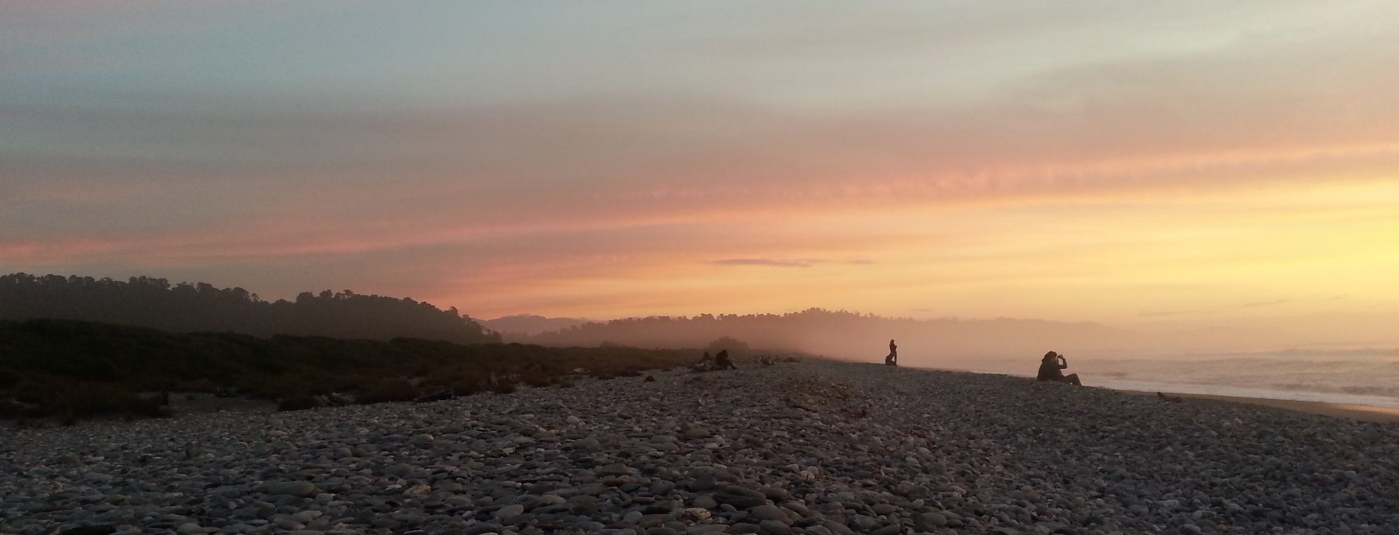
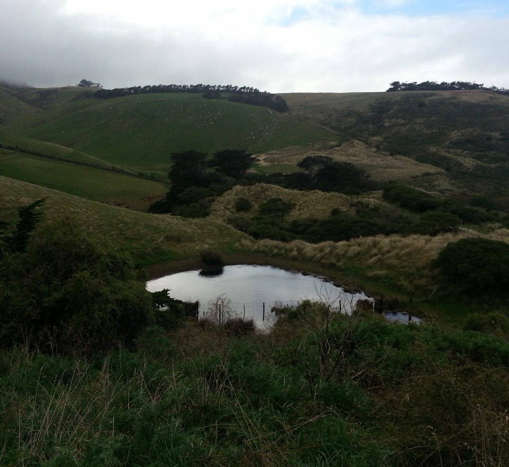
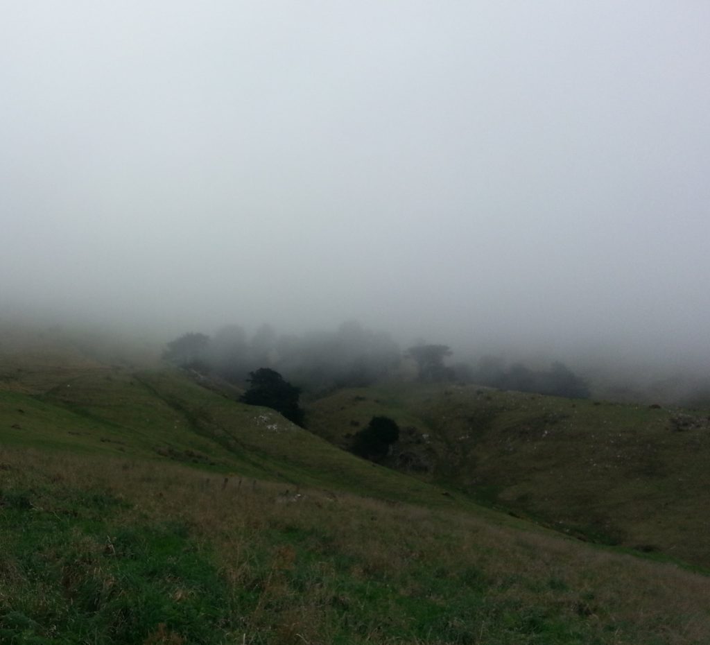
After a brief look at the small lagoon below the house (natural or man-made, I wonder?) we contemplated whether to continue to Boulder Beach, but a thick grey cloud was beginning to roll in, giving us cause to believe that the weather was on the turn. We decided to turn back the way we had come, past Buskin’s, as the incoming fog cast an even more strange and mysterious aura around our site on Shand’s estate.
Our morning had been just as rich in discovery as it had been in raising more questions. This is why I love exploring our Peninsula – not only is it often breathtakingly beautiful, but every inch of it is steeped in human stories!
References:
1901 Military Topographical Plan, W T Neill, Surveyor (various sheets)
1863 Surveyors Map, Norman Prentice (Block I)
Otago Peninsula by Hardwicke Knight
Page 12 Advertisements Column 4 Otago Daily Times, Issue 14801, 7 April 1910
Page 2 Advertisements Column 2 Otago Witness, Issue 418, 3 December 1859
The Taieri Plain : tales of the years that are gone by Margaret Shaw
PERSONAL Evening Star, Issue 15829, 14 June 1915
Shipping News. Otago Witness, Issue 314, 5 December 1857
Highcliff School, Otago Peninsula : centennial story, 1871-1971 by Dorothy MacDonald
OUR DEFENCES. TO THE EDITOR. Otago Daily Times, Issue 6829, 5 January 1884
THE PATENT ACT. Otago Daily Times, Issue 7253, 16 May 1885
Industrial Association. Star, Issue 5594, 15 April 1886
Evening Star Evening Star, Issue 6393, 12 September 1883
DEATHS. Otago Daily Times, Issue 7079, 23 October 1884
Page 33 Advertisements Column 3 Otago Witness, Issue 2467, 26 June 1901
Peninsula Road Board. Otago Witness, Issue 1803, 11 June 1886
A good yarn!
thank you for this history
Nothing beats the beauty of nature! We should take care of it.